GIS software development, GIS database design, Spatial data analysis, GIS consulting

2D/3D digital mapping, Indoor mapping, Cartography vectorization, Web map development

LiDAR data processing and conversion, Georectification and georeferencing, Vectorization and digitization, Data integration

Data capture and verification, Spatial data analysis, Cartography and mapping consulting, GIS web & app consulting

Floor plans digitalization, Indoor navigation, Building Information Model (BIM)

Data acquisition and digitization, Data conversion, Data cleansing and quality audit, Geospatial modeling and analysis

Geospatial Data Services - 8
Home » Services » Geospatial Data Services

Geospatial Data Services

Get a comprehensive view of your location data with our geospatial data services.

15
years of
experience
87
implemented
projects
12K+
working
hours
Geospatial Data Services - 9
Geospatial Data Services - 10 Geospatial Data Services - 11 Geospatial Data Services - 12

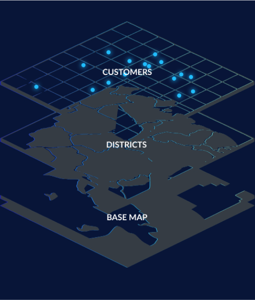
Maintaining spatial data is the key to all GIS systems. But things can get messy if you have your data gleaned from many diverse sources in varying formats and with tons of specific attributes. Our geospatial data company will ensure all your location details are captured, converted, and corrected so that your GIS system never lets you down in terms of accuracy and reliability.

Geospatial Data Services - 13 Geospatial Data Services - 14 Geospatial Data Services - 15

Geospatial data services we provide

Collect and process location data with ease

Data acquisition and digitization
Capture data with modern geospatial tech, like LiDAR or aerial / satellite / drone images; process it, and design a geodatabase for your unique business needs.
Data conversion and transformation
Convert or migrate your location data from CAD, legacy GIS systems, or hardcopy sources. Extract, Load, and Transform (ETL) formats from multiple sources and reconcile data conflicts.
Data cleansing and quality audit
Assess the quality of your existing geospatial data and address information silos, geometry issues, and location attribute inconsistencies to improve your business performance.
Geospatial modeling and analysis
Build advanced data visualizations and get actionable insights on the spatial relationships using their geographic coordinates or specific identifiers, such as street address and zip code.
Geospatial Data Services - 16 Geospatial Data Services - 17 Geospatial Data Services - 18

Benefits of our GIS data services

Drive your business decisions with correct, consistent, and usable location data

Manage sheer volumes of geospatial data effectively

Operating large sets of data becomes easier once it’s converted in the same format and calibrated by a single standard. Boost your GIS system reliability and make data management more efficient with Mappitall data experts.

Boost your business efficiency

Geospatial data analysis can inform you of the potential investment opportunities, process changes, or risks your business undergoes. Take advantage of this data to cut maintenance costs and maximize profits.

Improve decision-making

Once converted and aligned under a single format, geospatial data will provide a more comprehensive view of the environment. Consider the complete, relevant data when making important business decisions.

Partner with industry professionals

Accurate geospatial data is the core of any GIS system, and the Mappitall team serves to address this need. Hire geospatial data experts at Mappitall and resolve your location data challenges at once.

Geospatial Data Services - 19
Geospatial Data Services - 20
Geospatial Data Services - 21

Our work process

Kick off your project without extra hassle

1
Research & discovery
As soon as you contact us, we’ll schedule a call to discuss your specific business needs; determine the project scope; and outline the initial time & budget estimates.
2
Project planning
After signing the NDA and SLA, you’ll receive a detailed work breakdown schedule, a list of technologies to be used in the project, and your data format.
3
Data collection
Project execution starts with the data capture and production. We gather all the location info from your available materials, digitize paper maps or hardcopies, and go in the field to collect raw location data.
4
Data processing and conversion
The obtained raw data is processed, converted into a single format, and imported into a single geodatabase.
5
Data cleansing and quality control
We validate the data and ensure it’s fit for its purpose. The whole project is tested for any information silos or format inconsistencies. The data might be slightly modified or edited at this stage to improve spatial accuracy.
6
Project release
The data is finally pulled into a single database that serves as the core of your web or app product. If you don’t have one, we can further help to design and develop a GIS solution for your needs.
Geospatial Data Services - 22

Industries we serve

Real estate
Retail
Transportation and logistics
Agriculture
Insurance
Healthcare
Hospitality

Technologies we use

Tools and frameworks:
Geospatial Data Services - 23
Mapbox GL
Geospatial Data Services - 24
Leafletjs
Geospatial Data Services - 25
ArcGIS Online
Geospatial Data Services - 26
HERE Map JavaScript API
Geospatial Data Services - 27
PostgreSQL
Geospatial Data Services - 28
PostGIS
Geospatial Data Services - 29
GDAL/OGR
Geospatial Data Services - 30
Node.js
Geospatial Data Services - 31
QGIS
Geospatial Data Services - 32
JOSM
Geospatial Data Services - 33
UMN Mapserver
Geospatial Data Services - 34
Vue.js
Geospatial Data Services - 35
React
Languages:
Geospatial Data Services - 36
SQL
Geospatial Data Services - 37
PHP
Geospatial Data Services - 38
JavaScript
Geospatial Data Services - 39
Python
Geospatial Data Services - 40
HTML
Geospatial Data Services - 41
CSS
Formats:
Geospatial Data Services - 42
Shapefile
Geospatial Data Services - 43
GeoJSON
Geospatial Data Services - 44
GeoTIFF
Geospatial Data Services - 45
KML
Geospatial Data Services - 46
Vector Tiles (mbTiles, .PBF)
Geospatial Data Services - 47
netCDF
Geospatial Data Services - 48

Mappitall cases

Discover our GIS success stories

Geospatial Data Services - 49

GIS toolkit for COVID-19 Vaccines Nearby

The US healthcare authorities build a Vaccines.gov app with all COVID-19 vaccine providers across the country and up-to-date data on vaccine availability.

look into the case
Geospatial Data Services - 50

GIS toolkit for
Road Lanes

Movement of vehicles in real time.

look into the case
Geospatial Data Services - 51

GIS toolkit for FuseGIS

A real estate company designs a mapping solution to save time, cost, and resources for brokers and real estate agents.

look into the case
View more cases
Geospatial Data Services - 52

Leverage the latest geospatial data technologies with Mappitall

Reach out to us at Mappitall and get comprehensive geospatial data services from data collection to advanced analysis.

    Just contact us:

    Tell us about your project goals, and we’ll get back to you in no time!


    Frequently asked questions

    How much do geospatial data services cost?

    The cost of geospatial and data services will depend on the scope of your project and the region where you hire your team. For more precise budget estimates, contact us at Mappitall.

    How to choose a geospatial data service provider?

    Before choosing a tech partner, take a look at the geospatial data services and solutions they offer. Skim through their project portfolio and expertise and pay attention to reviews from their clients. Mappitall has been dealing with data collection, conversion, and analysis for over 15 years and helped 87+ businesses benefit from clean, accurate location data to the maximum.

    What should be prepared before contacting a GIS service company?

    Define your business needs, clearly articulate the problem, and preferably prepare the location data materials you might already have (like hardcopy maps or legacy GIS info). If you have no idea what to start with, contact us anyway. We’ll guide you through the process and devise the geospatial navigational data mapping services you might need.

    How can GIS data be applied to my business?

    GIS and data services have many use cases across all business verticals. For instance, if you’re an owner of a retail chain, you might use the location data to build new stores or close old ones. Governments can plan the communities’ infrastructure, housing, and other critical services; and insurers might assess risks for a location. Here at Mappitall, we offer geospatial data services for businesses of all sizes and industries.