technologies for mapping

Indoor Location Services

Help your clients navigate your property with ease and confidence.

  • 15

    years of experience

  • 23 094+

    hours

  • 112

    implemented projects

mapping analysts

Streamline Data with
Our GIS Solutions

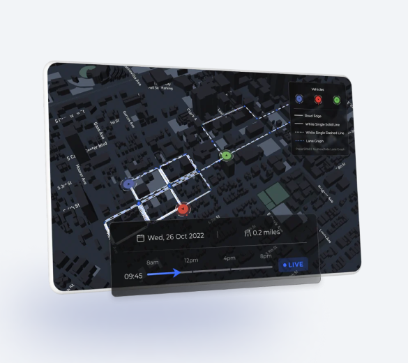
Indoor location-based services are the key to revolutionizing user experience. Yet, oftentimes it means nothing but an anchor point if the system isn’t accurate.

Mappitall can help you design a precise indoor positioning system to locate people or assets inside the building no worse than the satellite-based ones for outdoors.

dotted map image

INDOOR MAPPING SOFTWARE DEVELOPMENT SERVICES WE PROVIDE

Bring your floor plans to life

  • 01 FLOOR PLANS DIGITALIZATION

    Create the 2D/3D digital map from any blueprint or paper map and visualize you building to see your indoor data, spaces, and assets in a single place.

  • 02 INDOOR NAVIGATION

    Build a custom indoor tracking app for employees, contractors, and visitors to better orient themselves inside your facility and navigate it in real time.

  • 03 BUILDING INFORMATION MODEL (BIM)

    Design a digital twin of your facility with all the collected and processed information on its assets, amenities, and assignments.

global gis mapping

Let's bring your project to life!

Use our expertise to design your custom mapping software solution.

Let’s talk
BENEFITS OF OUR INDOOR-LOCATION BASED SERVICES

Access precise indoor location data in the palm of your hand

  • react icon

    Create indoor intelligence

    Indoor location tracking services provide valuable insights on the most common location use patterns. Leverage this data and use it to improve use experiences and workflows.

  • white map icon

    Enjoy superior location accuracy

    Unlike satellite-based GIS systems, indoor tracking solutions rely on Wi-Fi, Bluetooth, ultra-wide bands (UWB), and acoustic signals, among others to locate mobile tags. Capture objects with sub-meter accuracy.

OUR WORK PROCESS

Kick off your project without extra hassle

  • Research & discovery

    Soon after you reach out to us, we schedule a call to discuss your business requirements and objectives. We’ll determine the scope of work and provide the initial budget and timeline estimates for your project.

    01
  • Project planning

    During the project planning stage, you will receive a more detailed work breakdown schedule. We’ll decide on technologies to be used and help you choose the right positioning system for your needs and budget.

    02
  • Data collection

    Project execution starts with the collection of data. We re-draft poor-quality maps, digitalize paper maps, and obtain data from chips on the ground.

    03
  • Data processing

    The obtained data in processed, converted into a single format, and later imported into an database.

    04
  • Location-enabled software development

    The database is being connected to the back-end of your indoor positioning solution — be it a website or an app. We also design its user interface (UI) and develop the functionality in line with the initial scope of work.

    05
  • Quality control

    The indoor positioning system is carefully tested to ensure all anchor points are in place and the obtained data is precise.

    06
  • Project launch

    Your indoor map is released, and we sign our agreement off. If you enjoy working with us at Mappitall, you can always sign up for ongoing support and map maintenance services.

    07

Industries we serve

mapping industies

Technologies we use

Tools and frameworks:

tools and frameworks
programming langueges
mapping formats
global mapping

Let's bring your project to life!

Use our expertise to design your custom mapping software solution.

Let’s talk

Mappitall cases

Discover our GIS
success stories

View all cases
  • covid mapping frame

    COVID-19 Vaccines Nearby

    Bringing COVID-19 vaccine closer to
    the public with a web app
    Look into the case
  • navigation mapping

    Road Lanes

    Traffic simulation with road markings
    with hourly playback
    Look into the case
  • fusegis mapping

    FuseGIS

    This software solution allows deep data and GIS data analysis of absolutely all parcels and properties within the territories Precise Austin, Dallas, Houston and San Antonio, TX GIS Data
    Look into the case
View all cases
world map background image

Leverage the wealth of building Data and Floor Plans with Mappitall

Reach out to us at Mappitall and create the indoor map your visitors need.

Just contact us:

Tell us about your project goals, and we’ll get back to you in no time!

    Frequently asked questions

    • Reach out to us at Mappitall and create the indoor map your visitors need.

      Indoor positioning systems rely on data obtained from radio-based, optical, magnetic, an acoustic signals. Because GPS satellites are ineffective in closed spaces, a user’s device should receive impulses from anchor points or sensors installed in a room. This method of data collection guarantee fool-proof accuracy of the positioning system.

    • How do you build an indoor location system?

      To build an indoor positioning system (IPS), you have to set up equipment (aka anchors) at your office to receive signals from a user’s device. The chip on a user’s device will communicate with the anchor and forward the specific location to a server. Data is collected in real time and imported in a database in the back-end of your indoor location system.

    • How do indoor location services help with facilities management?

      Indoor positioning software development services help manage assets inside the facility better and improve user experience. They also increase efficiency for service calls, like in the hospital complexes or in large office buildings, and enhance safety of facilities and employees.

    • Why you should implement a digital indoor map in your business?

      Indoor location software development will help you create a smart office to improve productivity of your workforce and the experience of your visitors. For instance, your employees can find specific rooms, check real-time desk availability, or navigate the facility in search of routes that accommodate wheelchairs. You can also use a map for building management or emergency response plan.