Your vision, our
mapping solutions

Mappitall specializes in developing made-to-measure geographic information systems designed to meet your business needs

  • 15+

    years in the industry

  • 25050+

    hours of GIS expertise

  • 116

    successful deliveries

Our Services

weather prediction mapping

GIS Services Company

Read more
  • Interactive User Experience

    We equip businesses with intuitive GIS tools that transform complex geographic data into easy-to-navigate applications, giving users simple-to-use, organized maps.

  • Easy Data Management

    Let GIS handle your geospatial data, making it easy to store, access, and visualize information to identify trends and patterns essential for strategic decisions.

  • Actionable Spatial Analysis

    Extract insights and identify patterns from geospatial data with advanced spatial analysis techniques like clustering, interpolation, and modeling.

  • Project Support

    Our team can provide full support for your GIS projects. This will lead to enhanced decision-making, increased efficiency, and a strategic use of geographic information systems.

mapping for air traffic

GIS Consulting Company

Read more
  • Capture and Verify Data

    We ensure your geospatial data is always accurate and up-to-date. Our data capture and verification services turn raw field data into high-quality, reliable digital formats you can trust.

  • Made-to-Measure Solutions

    Uncover valuable trends and patterns with custom spatial analysis that supports informed decision-making, resource optimization, and market advantage.

  • Cartography and Mapping

    Transform complex geospatial data into clear, visual maps. Our cartography and mapping services enhance spatial awareness and communicate data more effectively.

  • GIS Web & App Integration

    Our development services provide dynamic spatial data processing, advanced analysis, and user-friendly interfaces to enhance business accessibility and functionality.

gis mapping services

GIS Mapping Services

Read more
  • 2D & 3D Digital Mapping

    Visualize terrain in detail: satellite, aerial, drone imagery, you name it. We incorporate detailed surface geological features to enhance your maps and optimize decision-making.

  • Interactive Floor Plans

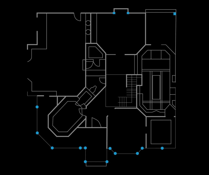
    Turn any facility or venue into a digital floor plan using the Building Information Model (BIM), allowing users to visualize internal layouts and navigate buildings or venues with ease.

  • Dynamic and Responsive Data

    Our cartography vectorization services convert static images into georeferenced, interactive data. Let your users navigate data above and beyond.

  • Create Interactive Maps

    We design engaging, interactive web maps that utilize geographic information and GIS technology. These maps allow users to visually represent and analyze geographic data for a variety of applications.

gis data conversions

GIS Data Conversion

Read more
  • LiDAR Data Processing and Conversion

    Integrate raw LiDAR insights into GIS-ready formats or high-accuracy terrain modeling, 3D visualization, and in-depth landscape analysis — even through dense foliage.

  • Georectification and Georeferencing

    Align your maps with accurately positioned real-world coordinates for accurate and reliable non-spatial data.

  • Raster-to-Vector Conversion

    Convert paper maps, aerial images, and other raster materials into precise digital vector data or formats suited to your needs.

  • Data Integration

    Integrate data from multiple sources, such as satellite imagery, vectorized maps, or drone imagery, and get a unified view of all available location information.

indoor mapping services

Indoor Location Services

Read more
  • Floor plans digitalisation

    View your indoor data, spaces, and assets in one place using 2D/3D digital map blueprints. Our data analytics services will help you understand space usage and optimize layout designs.

  • Indoor Navigation

    Build a custom indoor tracking app for employees, contractors, and visitors to help them orient themselves within your facility and navigate it in real-time.

  • Building Information Model (BIM)

    Create an accurate digital copy of your premises, including all assets, amenities, and features. This digital twin will allow you to better control the building’s lifecycle.

geospatial data services

Geospatial Data Services

Read more
  • Data Acquisition and Digitization

    Capture and digitize information for efficient storage, analysis, and decision-making. Our team is equipped with the tools to gather and process data using advanced geospatial technology.

  • Data Conversion and Transformation

    We transform data from CAD, legacy GIS systems, and physical sources, performing ETL processes to ensure compatibility and streamline operations.

  • Data Cleansing and Quality Audit

    We enhance the accuracy and reliability of your geospatial data by identifying and correcting inconsistencies and improving data quality.

  • Geospatial Modeling and Analysis

    Create data visualizations and get insights into spatial relationships using coordinates or identifiers.

Explore our GIS solutions in action

Vacfinder – Search Nearby COVID-19 Vaccines

Vacfinder is a web application developed to simplify COVID-19 vaccine access across the United States. Its interactive map provides real-time data updates, displaying current vaccine availability, pharmacy contact details, and hours of operation. Advanced search and filtering options allow users to narrow results by city, vaccination type, and more.

Technologies:

Mapbox GL
PostGIS
React.js

2045 CFX Master Plan – Blueprint Map

The Central Florida Expressway Authority plan is focused on future expressway innovations across the state. Through an interactive, real-time updated map, it displays planned routes and infrastructure expansions, this tool aids urban planners, engineers, and communities. Each expressway features a detailed explanation of project needs, benefits, and time frames.

Technologies:

Mapbox GL
PostGIS
React.js

Facility and Asset Management Solution – USA

The Management Tool is designed to optimize operations. This platform allows users to select specific dates, floors, and times to view and manage facility data with ease. With a color legend bar, users can instantly interpret various values and metrics, enabling informed, efficient management. This tool is a game-changer for operators, ensuring smooth operations and an enhanced experience for owners.

Technologies:

Mapbox GL
Post GIS
React JS

Residential Sales Project – UAE

Building model on Palm Jumeirah, Dubai featuring residence statuses: Free, Rented, or Sold. The 57 floors offer navigation and details, including building, floor, and unit status; number of bedrooms; suite area; balcony area; and total plan. These case studies are designed to provide an in-depth look at the building’s features and unit availability, enabling potential buyers and renters to make informed decisions.

Technologies:

Mapbox
PostGIS
ReactJS

Industries we serve

Agriculture
Healthcare
Sustainable energy
Transportation and logistics
Tourism
Real estate

...and beyond

Technologies we use

Tools and frameworks

Languages

Formats

  • Mapbox GL

  • leaflet icon

    Leafletjs

  • API

  • HERE Map API

  • PostGIS

  • GDAL/OGR

  • QGIS

  • JOSM

  • UMN Mapserver

  • SQL

  • PHP

  • JavaScript

  • Python

  • Shapefile

  • GeoJSON

  • GeoTIFF

  • KML

  • Vector Tiles (mbTiles, .PBF)

  • netCDF

Over 100+ clients trust us

Map in React with GIS functionality

★★★★★★

Jan 21, 2021 - Jul 15, 2024

"Vlad and his team are superb at creating minimal viable products (MVPs) for sales demos and your first customers. The team work around the clock to meet deadlines and are cable of producing excellent maps. Thanks!"

HomeEcMap // Interactive Online...

★★★★★★

Feb 5, 2024 - May 9, 2024

"I'm so lucky I found Vladimir's team for my project. Communication was super easy, they perfectly understood my needs and suggested great ideas. Everything from design to back-end is looking amazing and I can't thank them enough for the work they put in my project. Will definitely hire them again for another project in the future. Thanks a lot!"

Web Map using Angular

★★★★★★

Dec 11, 2023 - Mar 11, 2024

"The work with Mappital was great. The team understood our needs"

Backend developer with Map serv...

★★★★★★

Oct 4, 2023 - Nov 17, 2023

"Good collaboration! They are very quick to deliver the outputs to meet our deadline"

Address Matching in Database fun...

★★★★★★

Aug 31, 2023 - Oct 24, 2023

"Always a pleasure working with Vlad's team - we know their strengths very well having used them several times before, and they're superb at fulfilling both functional full stack and sophisticated algorithmic and database roles. Would recommend for their dedication, adherence to timelines, self-control over budget, and communication!"

Continuation of application scaling...

★★★★★★

Jun 14, 2022 - Apr 25, 2023

"Fantastic freelancers specialised in GIS and general development. Very versatile developers who we worked with for 18 months continuously, and who formed a close, cooperative, working relationship with our in-house engineers. Capable of taking on a huge variety of tasks, and unafraid to do so - with a distinct can-do attitude - that helped us progress from a small startup needing development expertise to a scale up company with rock solid foundations."

Let's bring your project to life!

Use our expertise to design your custom mapping software solution.

Let’s discuss your project

Read our latest GIS insights

Let’s discuss your project!

Use our expertise to design your custom mapping software solution

    FAQ

    • What is your domain expertise and which industries do you serve?

      Mapitall provides integrated mapping solutions across industries such as real estate, travel, logistics and transportation, sustainable energy, and more. Our team combines deep technical expertise with cross-industry knowledge, helping businesses achieve both short- and long-term benefits through customized geographic solutions.

    • What mapping services does Mappitall cover?

      Mapitall can develop custom mapping solutions for web and mobile platforms, utilizing such technologies as PHP, Python, JavaScript, Node.js, Vue, React, and more. We cover a wide range of services from cartography and data analysis to web map development and indoor mapping, delivering custom solutions that meet your business needs.

    • What is your cooperation framework?

      Mapitall offers flexible frameworks, including Time & Material (pay-per-hour) and Fixed Price (pay-per-project) models. To ensure both parties are aligned, we commence with a 4-6 week MVP (Minimum Viable Product) phase. This allows us to demonstrate our capabilities and ensure we’re a good fit for your project before moving forward.

    • How long does it take to develop a custom mapping project?

      On average, we deliver projects within 2 to 3 months. The timeline for creating a custom mapping solution depends on several factors, including the project’s complexity and data availability. For a more precise estimate, we encourage you to contact us directly.

    • Can Mapitall take over and complete an existing mapping project?

      Yes, we can. Regardless of its current stage, Mapitall can seamlessly take on your in-progress mapping project. If you’ve encountered challenges with previous developers, we’re here to help bring your mapping software to the highest standard.