
Management of complex topographic data is tough when you have only spreadsheets at hand. Our GIS & digital mapping company will deliver a modern, data-rich GIS mapping solution that will accurately represent spatial relationships and allow you not only to view the location-based information but also act on it.

GIS Mapping
Services
Transform data into online mapping solutions and get actionable insights for your business.
-
15
years of experience
-
23 094+
hours
-
112
implemented projects

Streamline Data with
Our GIS Solutions

GIS MAPPING SERVICES WE PROVIDE
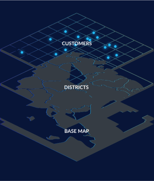
Stack layers on any map
-
01 2D/3D DIGITAL MAPPING
Add dimension to your map by capturing precise data of surface geological features from satellite and drone images, LiDAR surveys, georeferencing, and 2D & 3D data models.
-
02 INDOOR MAPPING
Visualize any facility or a venue into a floor plan or a Building Information Model (BIM) to facilitate indoor positioning and navigation for maps’ users.
-
03 CARTOGRAPHY VECTORIZATION
Transform rasterized images of geographical entities (like paper maps or aerial images) into instanced georeferenced data that can be subsequently manipulated in GIS.
-
04 WEB MAP DEVELOPMENT
Design an interactive map and deliver great user experiences using such technologies as Mapbox GL, Leafletjs, HERE Map JavaScript API, Google Map API, and ArcGIS Online, among others.

Let's bring your project to life!
Use our expertise to design your custom mapping software solution.
BENEFITS OF OUR GIS MAPPING SERVICES
Address your unique business needs with a data-driven map
-

Visualize complex geospatial data
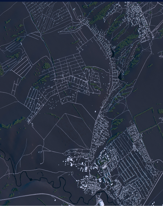
The beauty of GIS mapping is that it goes beyond mere coordinates. You can see objects in more detail when your map is organized in layers, each with its specific dataset and attributes. With our GIS mapping services, you will get a modern GIS system from satellite, aerial, or drone imagery; vectorized maps; or a 3D map in line with your business needs.
-

Obtain accurate data
Let’s be honest: paper forms and spreadsheets never display intricate spatial relationships. With a GIS map, you can eliminate all the guesswork. Our GIS mapping company captures real-time data, converts it into the required format, and places it on a map with a precision of up to a meter or less. As data layers are overlaid, you obtain a comprehensive view of the geodata and increase your location intelligence.
-
-
-

Improve your decision-making
Because GIS systems capture real-time spatial and geographic data, your map can inform your future business strategy. Mappitall experts will make sense of the scattered pieces of information and organize the complex geographical data into an interactive map, web app, or GIS system. You save time on answering site-selection questions, detect patterns, and make predictions on future trends.
-

Partner with industry professionals
With 15+ years in the GIS industry and over 90 successful projects, our online mapping company has extensive expertise in delivering modern mapping solutions. We are committed to the highest delivery standards and take a proactive approach to project development. Expect to see results from day one of our collaboration.
OUR WORK PROCESS
Kick-off your project without extra hassle
-
Research & discovery
As soon as you send us your project requirements and objectives, our GIS mapping agency studies them carefully and identifies the issues you wish to address with a GIS system.
01 -
Project planning
The initial research info is translated into specific project deliverables. At this stage, we identify the scope of work, i.e. the data to be collected, technology to be used, and time and budget to be allocated.
02 -
Data collection
The project implementation starts with obtaining data: redrafting poor-quality map sources, editing scanned images, surveying the ground, and setting up GIS/digital mapping software to accept data.
03 -
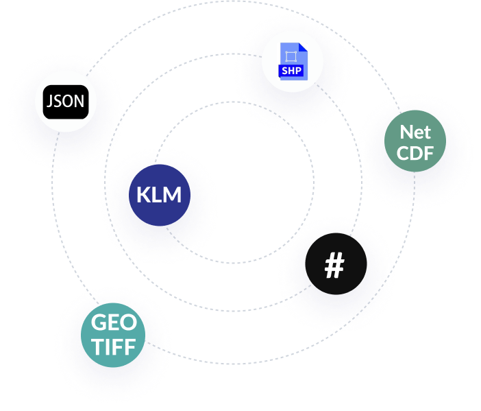
Data processing and conversion
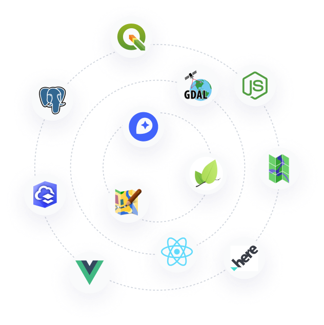
The obtained data is aligned and encoded into the required format. This data is later imported into a geodatabase and can be analyzed using such applications as QGIS, GDAL/OGR, Shapefile, etc.
04 -
App or map development
Once we have all the tools and data available, we create map components and add objects, layers, and overlays. Your app or web functionalities as well as user interface are built too.
05 -
Quality control
The project is delivered in phases, after which you provide your feedback and introduce changes whenever needed. Your map is carefully tested, bugs are fixed, and extra functionality is added.
06 -
Map release
Our GIS mapping company conclude our partnership and sign off the agreement. If required, you can further partner with our GIS consultants for any future improvements of your product.
07
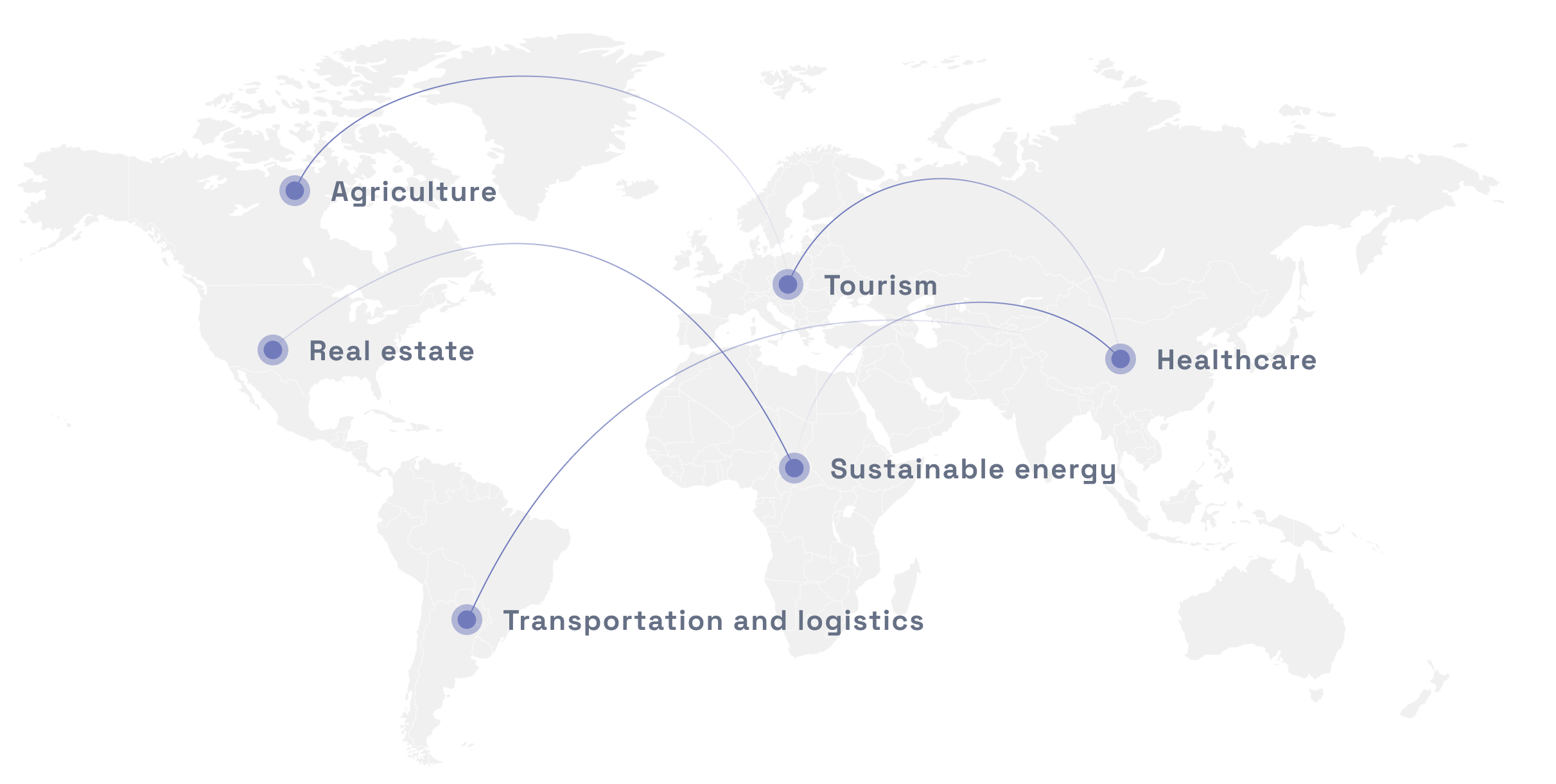
Industries we serve
Technologies we use
Tools and frameworks:


Let's bring your project to life!
Use our expertise to design your custom mapping software solution.
Mappitall cases
Discover our GIS
success stories
-
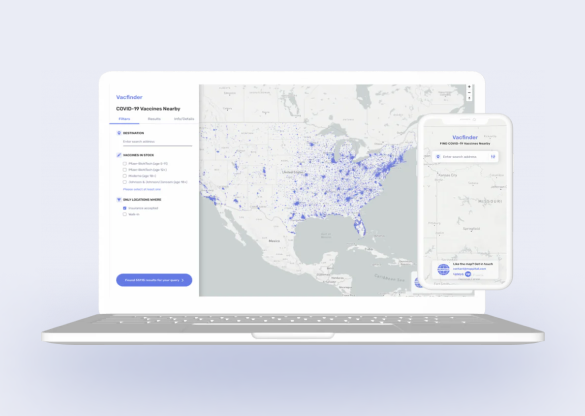
COVID-19 Vaccines Nearby
Bringing COVID-19 vaccine closer toLook into the case
the public with a web app -
-
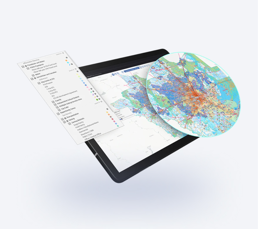
FuseGIS
This software solution allows deep data and GIS data analysis of absolutely all parcels and properties within the territories Precise Austin, Dallas, Houston and San Antonio, TX GIS DataLook into the case

Looking to create a modern GIS Mapping Solution
Count on our expertise in GIS mapping services no matter how challenging your project is.
Just contact us:
Tell us about your project goals, and we’ll get back to you in no time!
Frequently asked questions
-
How much data is needed to convert them into an efficient map?
The more data, the better. Extracting data from multiple sources – paper maps, satellite images, floor plans, or any other geospatial data sheets – will improve the accuracy and density of the digital GIS mapping solution.
-
Do you provide 2D/3D digital GIS mapping for enterprises?
Yes, of course. Whether you are a small business or a big enterprise, you can request 2D/3D digital GIS mapping services at Mappitall. For enterprises, such projects might be more complex, but our GIS mapping company is ready to undertake any challenge.
-
Can you design a custom web map for my travel business?
Absolutely. Tourism is one of the industries we serve, and the Mappitall GIS mapping company will gladly assist you with any mapping solution. Some of the technologies we work with are PHP, Python, Javascript, Node.js, Vue, and React, among others. After a careful consideration of your business requirements, we agree on the chosen tech stack and develop a web or mobile app for your travel business.
-
How much does it cost to build a real estate GIS mapping solution?
The cost to build a retail estate GIS mapping solution will depend on the complexity of the project itself. No matter which technology you use — Mapbox GL, Leafletjs, or ArcGIS Online, among others — the cost for your digital GIS mapping solution will depend on the hours spent to design and build it (time & material model) or the initially established price negotiated before the contract signature (fixed price model).
-
How many years has your company been engaged in GIS mapping services?
The Mappitall GIS mapping company has been on the market for over 15 years and accounts for over 90 successfully completed projects. When engaging with our company GIS mapping services, you will certainly deal with experts in web development, cartography, DB, navigation, data capture and entry, and research, among others. Count on our extensive expertise for your next ambitious digital GIS mapping project.
-
Who needs GIS mapping services?
GIS mapping services are a popular choice among real estate, urban planning, environmental, public safety, public health, and transportation organizations. They are also widely used in precision agriculture to measure and respond to the variability in crops.
-
How is GIS mapping done?
GIS mapping relies on spatial data analysis, including data capture, conversion, and ETL (Extract, Transform, Load). After geodata is aligned to a single format, it is pulled into a single database that serves as a basis for a GIS system, app, or map.
-
What are the main functions of GIS?
Every GIS system has four functions:
- Data capture from different sources, like hardcopy maps, satellite/aerial/drone imagery, technical drawings, and urban plans.
- Data storage is when the captured data is transformed into a raster or vector format for further query and analysis.
- Query implies that a GIS system stores sufficient information and attributes about a location to start analyzing its thematic and spatial characteristics.
- Analysis is when the user can retrieve graphs, tables, and overlays for further examination.