Best GIS Software: How to Choose the Perfect One for Business
Best GIS Software: How to Choose the Perfect One for Business
May 15, 2023
Guides
Author: Volodymyr Ovramenko
Reading time: 10 minuntes
If you are a business owner and want to keep pace with the latest tech trends, the information on GIS software is right for you. GIS mapping software assists different industries in solving their issues and getting valuable insights from geographic data. However, with so many decent options on the market, choosing the best GIS software may be challenging. In this article, you will learn everything you need to know about mapping software to get the most benefit for your business.
What is GIS Mapping Software?
Geographic information system mapping software is a powerful tool for creating, editing, managing, analyzing, and visualizing geographic data on digital maps. It can help organizations and businesses analyze data effectively and present it clearly for different purposes.
GIS Systems Software typically includes several components, such as:
Data management for storing, organizing, and retrieving data. Users can import and export data from various sources, such as databases, spreadsheets, and GPS devices.
Mapping and visualization for creating custom maps and visualizing geographic data in different formats, such as 2D and 3D maps and satellite imagery.
Geocoding and address matching are used to match addresses to specific places on a map and vice versa. There is the best free GIS software for converting address data to geographic coordinates and vice versa.
Geospatial analysis for performing advanced spatial analysis on geographic data, including identifying patterns, relationships, and trends. Businesses can benefit from overlaying and intersecting data tools.
Web and mobile access for sharing GIS data and maps through web and mobile applications. Users can publish maps and data to the web and access GIS data and maps on mobile devices.
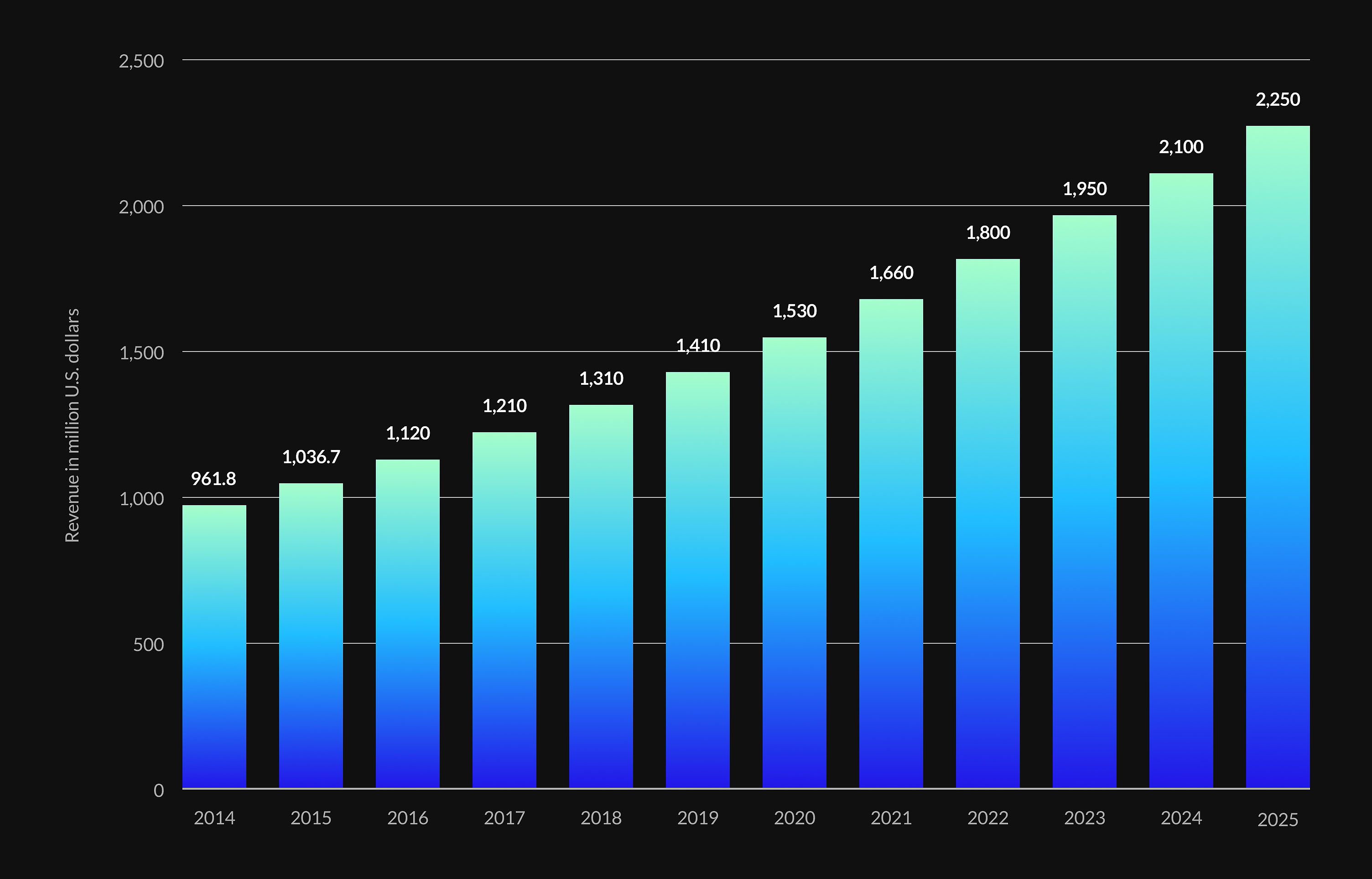
Mapping software is quite popular these days, and if we look at the statistics, the Geographic Information System market revenue will amount to 2,250 million dollars in the United States in 2025.
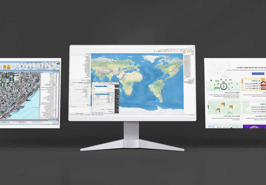
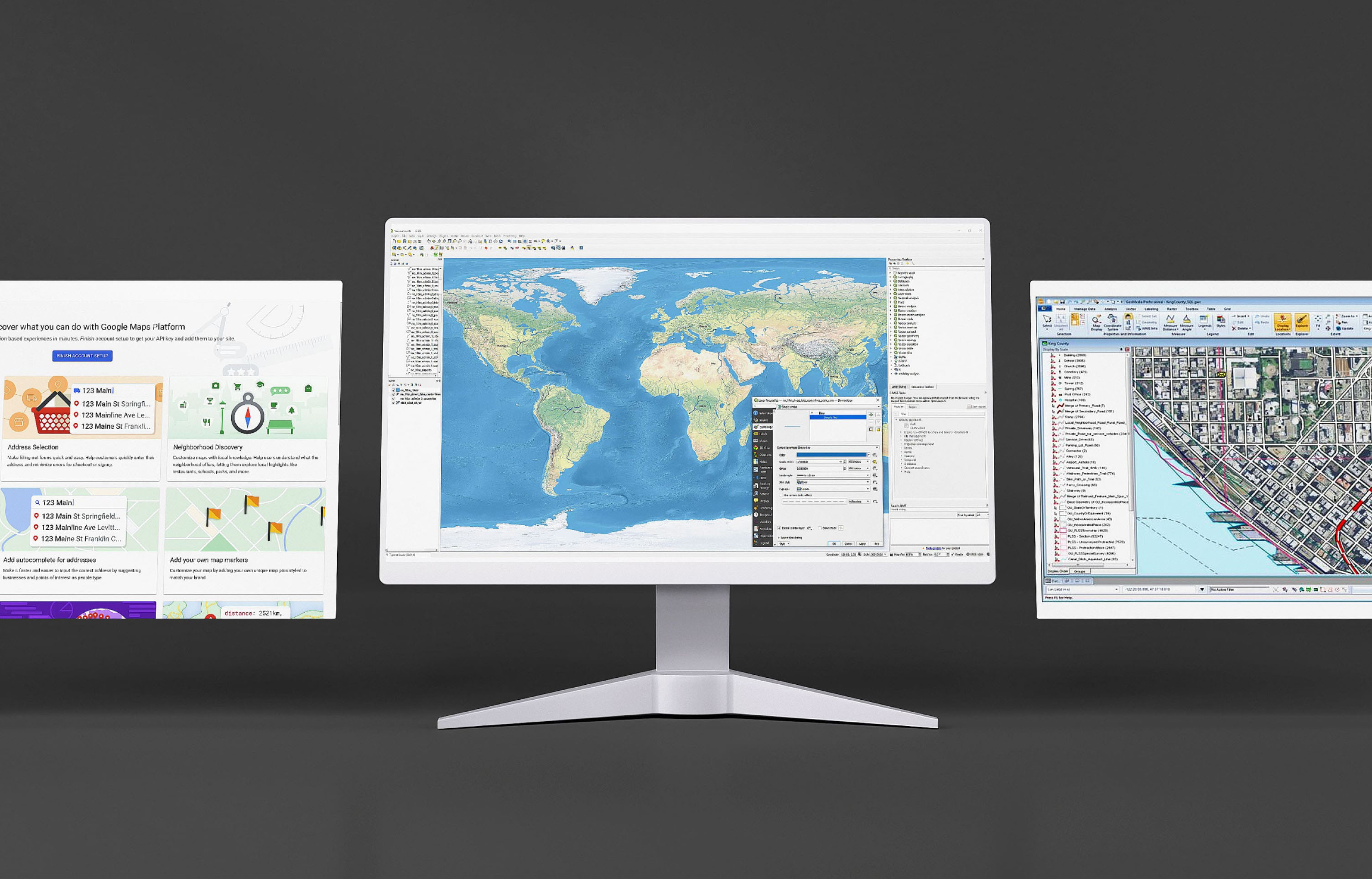
If you look at popular GIS systems software examples, like Google Maps Platform, GeoServer, Esri ArcGIS, QGIS, MapInfo, GeoMedia, etc., you will see they vary in features, complexity, and cost. So determine the needs of your business and make the right choice.
What Is a GIS System Used For?
Once you have a clear idea of what GIS software is, let’s take a closer look at its applications. GIS systems can be used in various industries for data visualization and mapping. It allows organizations that deal with large amounts of spatial data to manage and analyze it more effectively. Businesses benefit from GIS solutions by identifying potential markets, analyzing consumer behavior, and optimizing supply chain management.
Many other industries solve spatial problems with the help of GIS software. GIS can help in urban planning, environmental management, agriculture, emergency management, sales, franchising, marketing, and transportation. For example, the environmental management industry uses GIS to monitor and manage natural resources, track changes in land use and land cover, and analyze the impact of human activities on the environment. And agriculture GIS software is used to optimize crop production, manage natural resources, and analyze weather patterns.
Types of GIS Software
You know what GIS software is used for, so now it’s time to learn more about its types and the best examples. In this section, we’ll explore desktop, web, server, and specialized GIS in detail.
Desktop GIS
Desktop GIS, or desktop geographic information system, is a tool for managing, analyzing, and visualizing geospatial data on a desktop. This software enables users to integrate and analyze data from various sources, such as GPS data, satellite imagery, and demographic information. It is used by many professionals like scientists, engineers, and researchers in different fields, including environmental management, urban planning, emergency management, real estate, and transportation.
Functions: data capture, storage, analysis, visualization, and data sharing.
Features:
Higher data accuracy and quality;
Improved decision-making;
More efficient data analysis;
Enhanced collaboration and communication.
Pros:
Robust data analysis capabilities;
Wide range of data formats;
High-quality visualizations;
User-friendly interface.
Cons:
Requires significant computational power and storage;
Quite expensive;
Require specialized training.
Let’s explore some examples of GIS systems for desktops: ArcGIS Desktop, and QGIS software etc.
Web GIS
A web-based geographic information system is a software for managing, analyzing, and sharing geospatial data over the Internet. Users can access geospatial data from any location and device. If you wonder what a GIS system is used for when operating on the web, this section will give you all the necessary insights. Many professionals use web GIS in various fields, including urban planning, real estate, environmental management, transportation, and emergency management.
Functions: geospatial data management, spatial analysis, visualizations of geospatial data, and data sharing.
Features:
Users can access data from any device via an internet connection;
Users can collaborate and communicate in real time for better problem-solving;
Web GIS can meet changing needs effectively by scaling up or down easily;
It’s a cost-effective solution that doesn’t require expensive hardware and software.
Pros:
Easy accessibility and sharing of geospatial data
Allows for real-time collaboration and communication
Scalable and flexible
Low GIS system cost.
Cons:
Requires a good internet connection;
Low processing power;
Security concerns.
Top 3 software: ArcGIS Online, Google Maps API, and GeoServer.
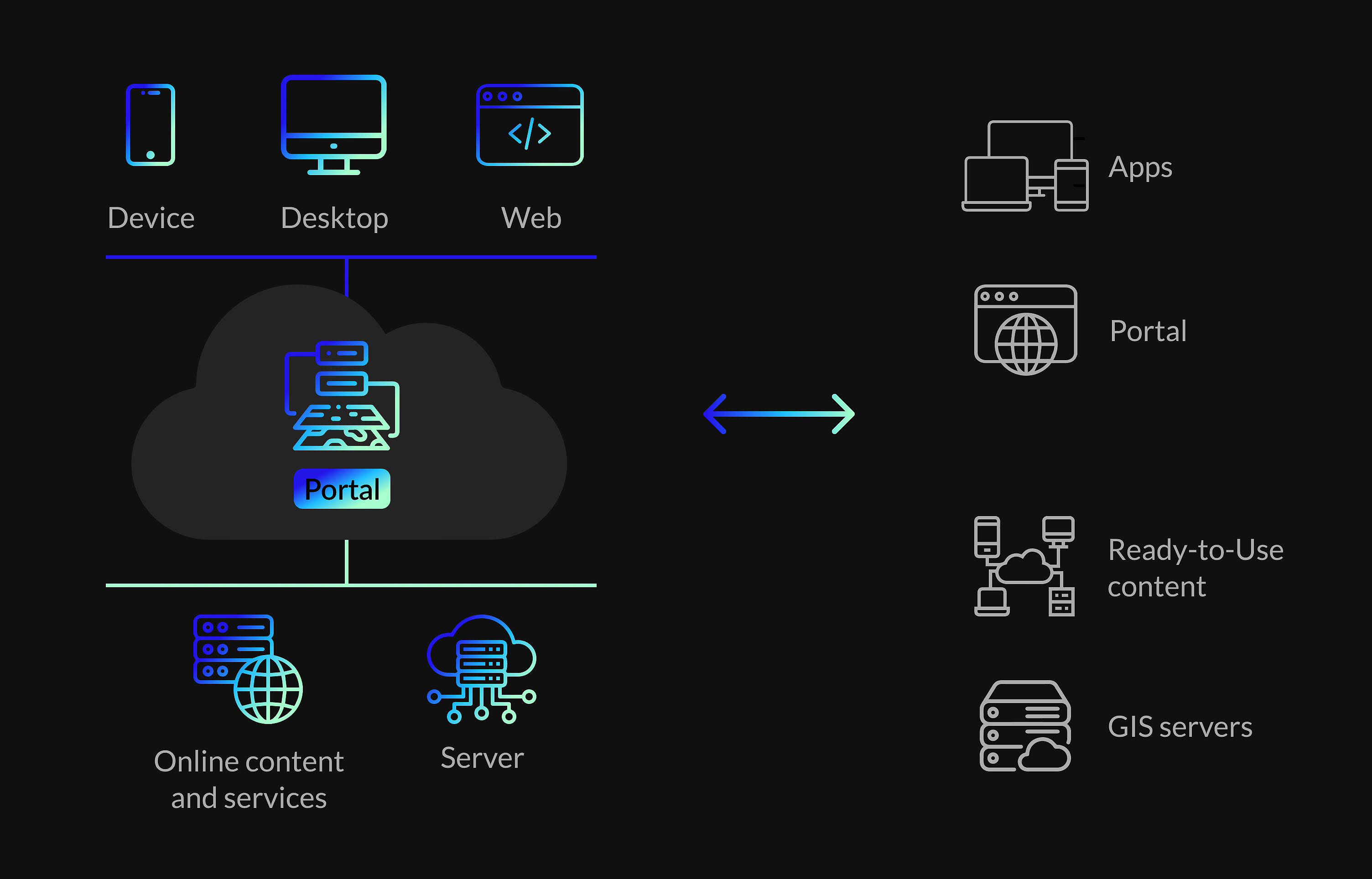
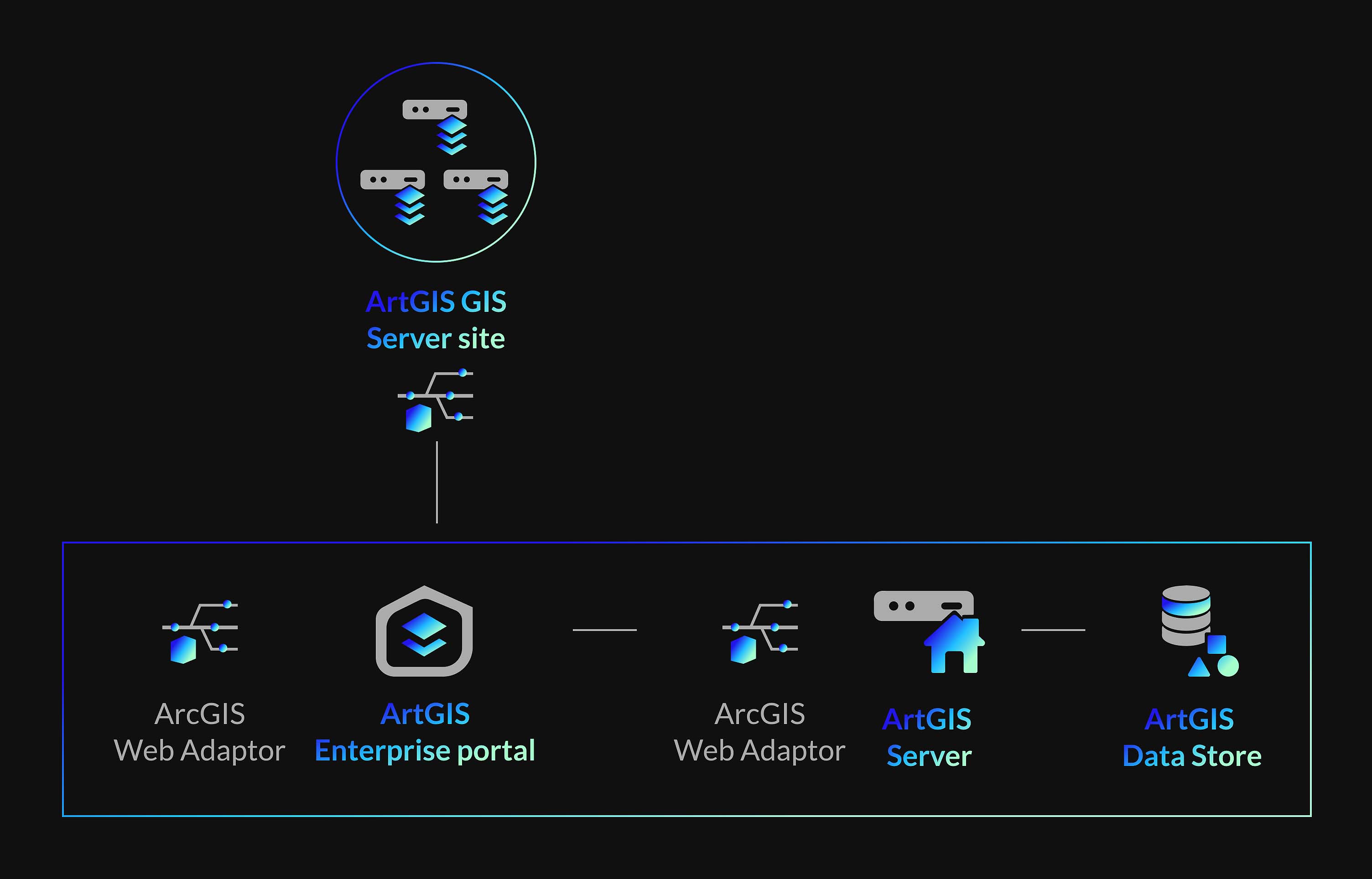
Server GIS
GIS software provides GIS services over the Internet or an intranet network where multiple clients can access software on a central server. Users can easily access and work with GIS data and applications through a web browser or other client applications, regardless of location. It is used by various organizations, especially those that need to share GIS data and applications across different departments or with external stakeholders.
Functions: data storage and management, data sharing and collaboration, data processing and analysis, interactive map publishing and visualization, and integration with other systems.
Features:
There’s a centralized repository for storing, managing, and updating GIS data;
It can be customized to meet unique business needs and requirements;
Server GIS software is great for real-time data processing and analysis;
It allows users to access and use GIS data and applications remotely;
Users can boost their productivity thanks to effective processing and analyzing large volumes of data.
Pros:
Improved collaboration and data sharing;
Scalability;
Centralized data management and security;
Different customization options;
Greater efficiency and productivity;
Integration with other systems.
Cons:
High cost;
Technical expertise;
Resource-intensiveness.
Top 3 GIS mapping software for free: ArcGIS Server by ESRI, MapServer, and GeoServer.
Specialized GIS
Specialized GIS is systems software specifically designed for mapping and analyzing spatial data. Various industries, like urban planning, environmental management, natural resource management, etc., benefit from this tool. Specialized GIS can be used by geographers, engineers, architects, government agencies, transportation planners, real estate developers, and more.
Functions: collecting data, storing and organizing data, analyzing data, creating maps and visual representations of the data, geocoding, routing and navigation, spatial analysis, and querying.
Features:
It can help manage and organize large volumes of spatial data;
Users can better understand the spatial relationships between different features;
The software increases productivity and saves time due to task automation;
It ensures excellent accuracy so that users can benefit from reliable data;
It’s a great choice for emergency response and resource management due to its detailed real-time information;
Users can communicate easily, thanks to a visual representation of data.
Pros:
High level of accuracy;
Task automation;
Better decision-making;
Improved communication and collaboration.
Cons:
Requires specialized training and expertise;
Quite expensive;
May take a lot of time to collect and analyze data.
Top 3 software: ArcGIS, QGIS, and GRASS GIS.
How to Use GIS Software?
If you want to learn how to use GIS software, these simple steps will help you start your GIS journey.
Find good GIS software
Collect data
Analyze data
Create maps
Share your results
So to get started using this tool, you should first find high-quality GIS software. You can come across open-source and commercial options. It’s also possible to purchase GIS software development services and get a customized tool.
The next step is collecting data from different sources, including GPS, satellite imagery, aerial photography, and more. Spatial data will include information about the location of features on the earth’s surface. When using GIS software, you should organize your data into relevant layers and ensure they are in a compatible format with your GIS software. Then load the data into the GIS software.
After that, you can analyze spatial data using different techniques. This will help you identify patterns, trends, and relationships between different features. With the help of GIS software, you can create and customize maps with various visual elements. When everything is ready, users can share the results of created maps and analyzed data by exporting them to any format they need.
Consider that each GIS software package has unique features, so getting familiar with tutorials and courses is recommended.
In this list, you can find tips on how to select the best GIS software for beginners. If you are a business owner searching for a decent geospatial data tool, this guide is the right choice.
Before choosing software for GIS, you should understand your needs and answer some key questions. Decide whether you need to create maps on your own, map existing data, collect field data, or collaborate with your team members. Answers to these questions will help you identify your unique requirements and move in the right direction when choosing the best software.
When you have several good options on your list with proper functionalities, consider the following factors: interface, cost, compatibility, integration, and reputation. Today you can find free and expensive GIS mapping online options, so consider your budget. It’s recommended to try trial periods of paid software to see whether they are worth their money. You should pay attention to software with a user-friendly and intuitive interface. Consider that the tool you choose can handle and integrate your existing data. And finally, it’s important to use software with dedicated customer support and positive user reviews.
FAQ
What GIS software is widely used by entrepreneurs?
Each GIS software has unique functionalities to provide high-quality mapping solutions for business owners. Mapbox, QGIS, and Google Maps API are some of the most popular options. You can also benefit from Mappitall’s GIS development services for customized software.
Which GIS software is best for the real estate business?
Real estate business owners should consider such software for GIS as GeoData Plus, GeoPlanner, or MapInfo. It’s crucial that the software meets your needs and has tools for property research, market analysis, and property valuation.
Why use GIS software?
GIS systems software is used for various purposes, including data visualization, data management, spatial analysis, decision-making, and collaboration via sharing maps and data.
What is the most popular GIS system?
There are various commercial and open-source GIS software systems. They have different functionalities that can meet the unique needs of your business. You can choose server, web, desktop, and specialized software systems based on your demands. ArcGIS by ESRI is one of the most popular GIS systems software.
Why Choose Mappitall Software Development Services
Today, software for GIS can be beneficial for any kind of business. It allows entrepreneurs to make informed decisions, improve resource management, increase operational efficiency, and improve customer engagement and risk management. In addition, spatial data analysis can give organizations valuable environmental information and make businesses more successful.
Mappitall is one of the most reliable solutions for high-quality GIS services. Business owners can get the best GIS software based on their unique needs and preferences. At Mappitall, experienced developers can create a top-notch GIS tool to improve your company’s performance. If you have any questions, contact our support team and take the first step to implement modern geospatial solutions in your business.
Get in touch with us
Want to discuss your project?
Use our expertise to design your custom mapping software solution.
Just contact us:
Tell us about your project goals, and we’ll get back to you in no time!
An entrepreneur and business leader, Volodymyr began his career in the late 1990s at the Laboratory of Geoinformation Systems of the Kharkiv National University of Radioelectronics.
In 2007 Volodymyr created Mappitall, and grew the company from a small agency providing GIS solutions to one of the industry leaders in Ukraine, a reliable technology partner for many international enterprises and top-level organizations around the world.
As CEO, Volodymyr is the driving force behind the company’s strategy and business development, actively working on the development of Mappitall’s business model, attracting more and more talented people who share his vision and mission.