Underground Utility Mapping: What Is It and Its Functionality?
Underground Utility Mapping: What Is It and Its Functionality?
September 25, 2023
Guides
Author: Volodymyr Ovramenko
Reading time: 11 minuntes
Beneath our feet lies an intricate web of utilities that power our cities, deliver essential services, and keep our lives running smoothly. Underground mapping services make infrastructure reliable, efficient, and safe.
According to market forecasts, the underground utility mapping market is expected to witness a remarkable compound annual growth rate (CAGR) of 9.40% between 2018 and 2028. Underground utility mapping software plays a critical role in optimizing urban planning, infrastructure development, public safety, and more.
Read the article and find out what underground mapping is, its vital functionality, and why it’s crucial for our modern world.
What Is an Underground Mapping Service?
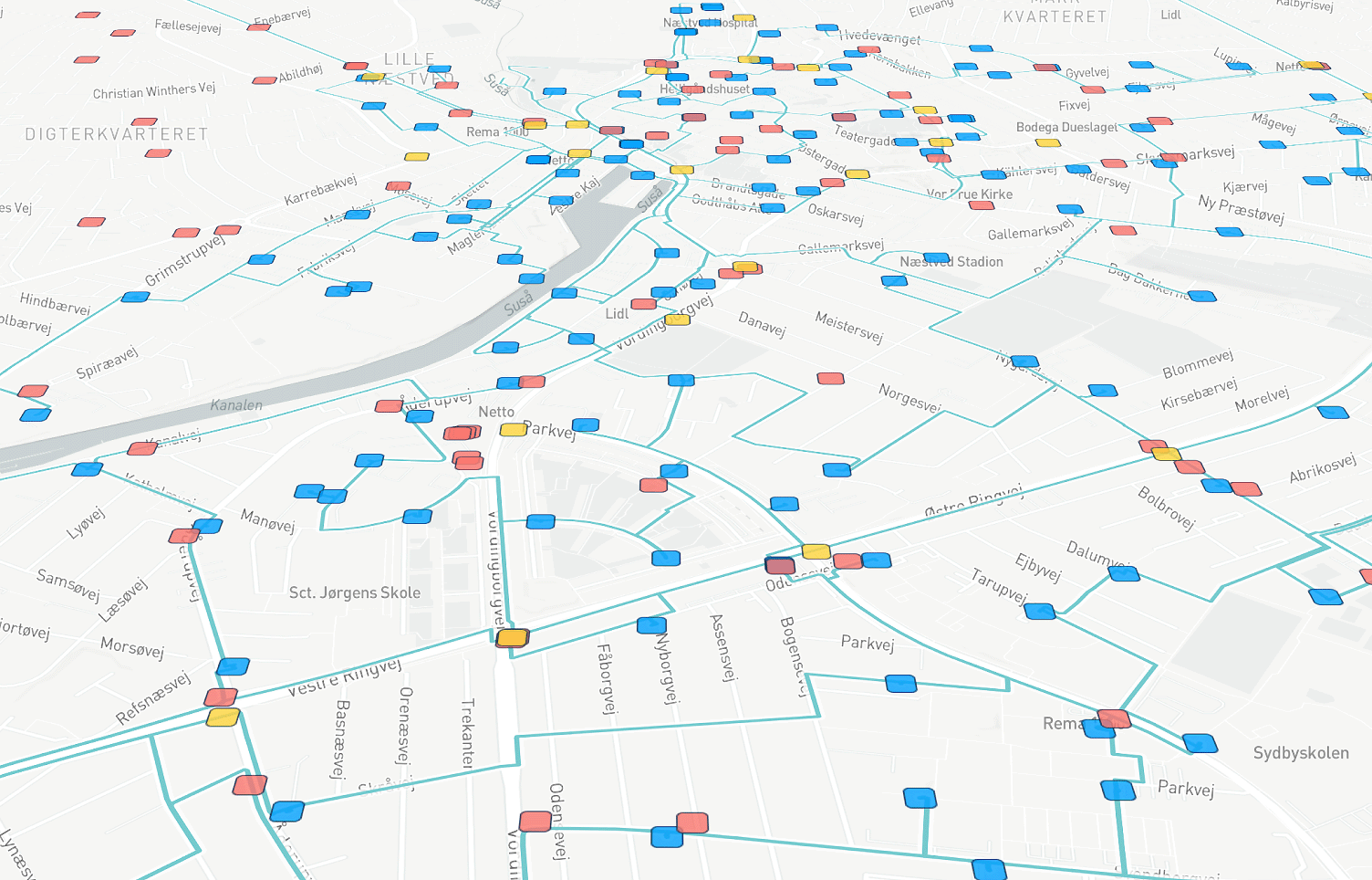
Underground mapping services are professional tools that help locate and map underground utilities. They involve the use of specialized equipment, such as GPR, GIS, electromagnetic locators, etc. These non-destructive techniques allow the detection of buried utilities like electrical cables, water pipes, gas lines, etc. Underground utility mapping accurately depicts the subsurface environment in different formats, including 3D.
Underground utility detection & mapping services provide crucial information that enhances safety. They enable efficient project planning and design. Besides, accurate mapping optimizes resource allocation. With underground utility mapping software, organizations get crucial insights for making informed decisions.
Which Utilities Need Underground Mapping?
Several utilities require underground mapping services for accurate location and management. Here, we’ll outline some of the essential utilities using mapping:
Water supply lines: underground utility mapping software helps identify water supply lines, their routes, sizes, and connections. It’s critical for preventing accidental damage during construction. Workers know when to repair and maintain water supply lines.
Gas pipelines: mapping gas pipelines is vital for the safe transportation and distribution of natural gas. Leaks or accidents are hazardous to the public and the environment. And gas pipeline mapping is an effective preventive measure.
Electrical cables: people use underground electrical cable mapping to avoid accidental damage during construction activities. It ensures safe and reliable electricity distribution.
Telecommunications networks: efficient telecommunication services rely on network mapping. It aids in the planning and deployment of communication services. Workers can locate faults and prevent damage during construction or utility work.
Sewer systems: with underground mapping of sewer systems, people enjoy the proper functioning of sewage networks Moreover, it helps prevent environmental contamination and public health risks.
Stormwater drainage: underground utility mapping software helps manage water run-off during heavy rainfall. It reduces the risk of flooding and property damage.
Fiber optic cables: with the increasing reliance on high-speed internet and data transmission, accurate mapping of fiber optic cables is vital for efficient network management and expansion.
District heating and cooling: mapping district heating and cooling systems assists in optimizing energy distribution and reducing energy waste.
As you see, underground utility mapping services are vital for various utilities. They ensure safety, efficient operations, and sustainable infrastructure development.
Methodology of Underground Utility Detection & Mapping
Underground mapping services methodology is a series of systematic steps and specialized technologies. They enable the proper location, identification, and documentation of underground utilities. The process includes the following steps:
Initial data collection: the process begins with gathering existing data about the site’s utilities from available resources. These include records, as-built drawings, utility owners, and historical maps.
Site survey: surveyors conduct on-site inspections to verify the location and type of utilities indicated in the initial data.
Non-destructive testing (NDT) techniques: they help identify buried utilities without causing damage. GPR and electromagnetic induction methods detect subsurface objects and assess their characteristics.
Utility locating equipment: this specialized equipment allows for the precise locating of underground utilities. Electromagnetic locators can detect conductive utilities, while GPR identifies non-metallic utilities like plastic or concrete pipes.
Data integration and processing: then specialists integrate collected data and create a comprehensive utility map. GIS software helps manage and analyze the data.
3D modeling: 3D models of the underground infrastructure provide a more detailed view of the utilities’ spatial relationships.
Quality control and validation: quality control checks and comparisons with known data prove the accuracy and reliability of the utility map.
Reporting and documentation: the final utility map is presented in a clear and easily understandable format. It includes information about the location, type, depth, and condition of the underground utilities.
The methodology of underground utility mapping and advanced technologies ensure accurate and detailed information.
Importance and Benefits
What is the significance of underground mapping services? The answer is quite simple: to prevent damage and reduce cost. Any excavation activities are based on underground mapping. They allow people to identify the depth, diameter, and route of different utilities for their purposes. Just imagine, we use essential services, such as water, electricity, gas, and telecommunications daily. These utilities are underground, and knowing their exact locations is crucial. Let’s find out the benefits of using underground utility detection & mapping services:
Safety
Underground mapping services help prevent accidents by locating underground utilities. Construction workers and the public avoid damaging gas lines, electrical cables, water pipes, and other crucial infrastructure.
Costs and Time-Efficiency
Using underground utility mapping software, you can enhance project planning. Mapping saves you time and money, as you can identify potential obstacles in advance. Besides, this allows people to prevent delays, rework, and repairs during construction.
Optimizing Resource Use
Utility mapping optimizes resource allocation and infrastructure planning. Accurate mapping helps identify areas needing upgrades or expansions, improving the efficiency and capacity of utility networks, and leading to better resource management and future planning.
Enhanced Emergency Response
Utility mapping supports emergency preparedness. During emergencies, responders can access utility data to locate shut-off valves, isolate affected areas, and respond quickly, safeguarding lives and minimizing damage.
Supporting Sustainable Development
Underground utility mapping software contributes to sustainable urban development. It provides valuable information for city planning and infrastructure projects. Urban planners can optimize land use, ensure infrastructure compatibility, and minimize disruptions.
Minimizing Disruptions
Utility mapping aids in effective maintenance and repairs. Utility providers can maintain and quickly address issues with underground utility mapping software. That’s because they have a clear picture of the underground infrastructure. This reduces service disruptions and ensures a steady supply of utilities.
Regulatory Compliance
One of the important benefits of underground mapping is compliance with regulations. These may be construction, excavation, and utility management regulations. Accurate mapping shows your adherence to safety standards and environmental regulations.
Drawback of Underground Utility detection & Mapping Services
Underground utility detection & mapping services offer a range of benefits, but there are certain potential limitations:
Quality of Utility Data
The completeness of underground mapping data available for mapping can vary significantly. Inaccurate or outdated records and incomplete information can pose challenges during the mapping process. Reliable and up-to-date utility data is crucial for ensuring the accuracy and reliability of the mapping results. Missed or incorrectly mapped utilities may lead to accidental damage during construction or excavation.
Equipment and Technology
The effectiveness of underground utility detection & mapping services heavily relies on the quality of the equipment and technology. Advancements in scanning technologies have improved detection capabilities. However, the availability of these advanced tools may vary across different regions or service providers.
Legislation on Underground Utility Mapping
Legislation and regulations on underground utility mapping vary between jurisdictions. The lack of standardized regulations may have negative results. These include inconsistencies in mapping practices, data sharing, and responsibilities among stakeholders. Implementing clear legislation can help ensure reliable underground mapping.
Populating The National Underground Utility Database (PADU)
Many countries are establishing underground mapping databases to manage utility data. However, the process of populating these databases with accurate information can be time-consuming and challenging. Collaboration among utility companies, government agencies, and mapping service providers is vital. It ensures the successful development and maintenance of such databases.
Underground utility detection & mapping services have some other cons. For example, limitations in remote areas, cost and time constraints, complex urban environments, etc. Thankfully, continuous advancements in technology and data collection methods help improve the accuracy and efficiency of underground mapping services.
Why Does Your Business Need It?
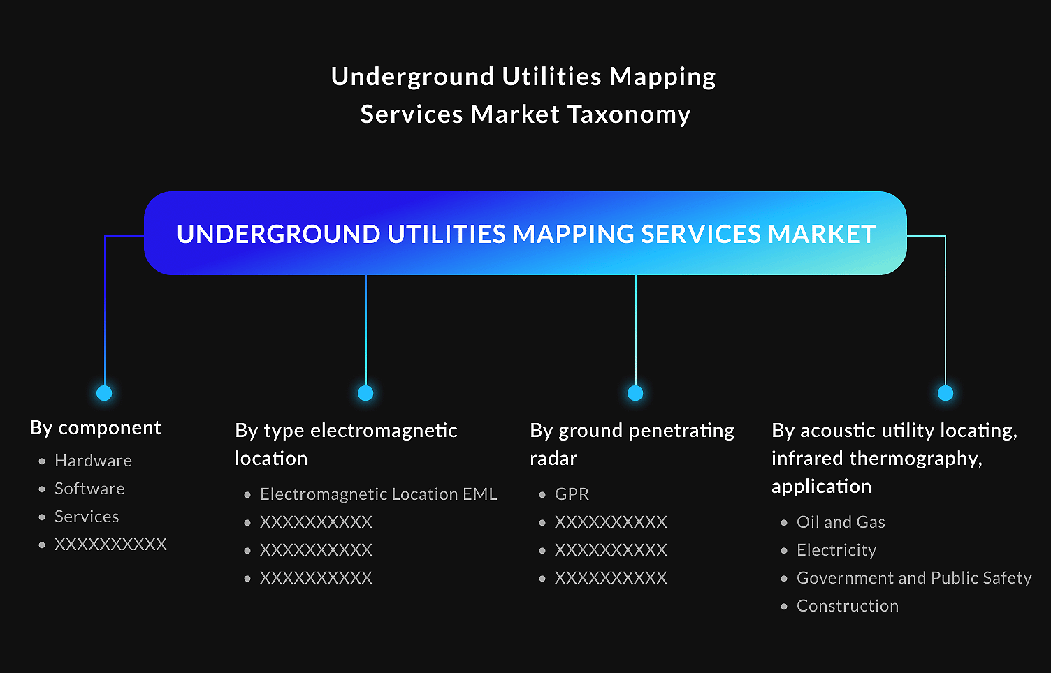
Underground mapping services are used in various industries. According to Dataintello, they are applied in Oil and Gas, Electricity, Government and Public Safety, Construction, Telecommunication, Transportation, Water and Wastewater Management, Agriculture.
However, there are many other industries that may use underground mapping. Here we will look at the reasons why various sectors find underground mapping valuable:
Energy and utilities: these companies use underground mapping services to manage and maintain their infrastructure. It helps them identify underground cables, pipelines, and distribution networks.
Emergency services: they benefit from underground utilities mapping to handle emergency situations. These may be natural disasters, search and rescue operations, evacuations, etc. Emergencies can enhance their response capabilities, minimize risks, and ensure safety.
Transportation: they plan road expansions, tunnels, and bridges using underground utility mapping software. It helps identify potential issues and prevent them. In such a way, transportation infrastructure projects proceed smoothly and safely.
Urban planning: underground mapping helps urban planners understand the infrastructure when developing urban areas. They place new developments, use land, and regulate zones consciously.
Telecommunications: they need advanced underground utility mapping software to plan the installation of cables and optimize network connectivity. It helps them avoid disruptions and operate efficiently.
Environmental management: it assists them in locating certain objects and processes important for understanding the impact of subsurface structures on ecosystems. Mapping underground assets aids in environmental planning and protection.
Archaeology: underground utility detection & mapping services enable archaeologists to locate and protect cultural heritage. Understanding the past is crucial for future development.
The ability to accurately visualize and understand the underground landscape is important. It empowers various sectors to make informed decisions, mitigate risks, and optimize their operations.
FAQ
What is used to map the underground?
Various technologies are used to map underground utilities. Underground utility detection & mapping services include Ground-Penetrating Radar (GPR), Geographic Information Systems (GIS), Global Positioning System (GPS), Electromagnetic Locators (EML), etc. The type of technology depends on the specific requirements of a project and the type of utilities. A combination of these technologies ensures accurate results.
What is underground scanning?
Underground scanning is a technique that uses special tools to gather information about what is hidden beneath the ground. It helps detect and map underground utilities like pipes, cables, and sewer lines. Underground scanning creates images or maps of the buried infrastructure. It uses technologies such as ground-penetrating radar and electromagnetic locators. This process is crucial for construction and excavation projects to avoid accidentally damaging underground utilities.
How to do underground utility mapping?
Underground mapping involves several steps to accurately locate and map utilities. Here is an overview of the process:
1) Planning and research. Gather any available data about the site.
2) Site survey. Conduct a comprehensive survey of the site using specialized equipment and techniques.
3) Data collection. Record the location, depth, and type of utilities detected during underground mapping.
4) Mapping and documentation. Create detailed maps and documentation that represent the underground utilities using underground mapping services.
5) Data verification and validation. Verify the accuracy of the collected data using cross-referencing and additional scans.
6) Reporting and communication. Prepare comprehensive reports and share the findings to ensure the efficient execution of projects.
The process may vary depending on the project requirements and the available equipment and resources.
Conclusion
We can live in smarter, more sustainable cities with underground utility mapping. This survey is a crucial aspect of modern infrastructure development and maintenance. It allows us to uncover the hidden web of utilities, ensuring safety, efficiency, and sustainability. The projected growth of this market highlights the increasing demand for accurate underground utility data.
Underground utility mapping software is a valuable tool that helps prevent accidents and optimize urban planning. People can work harmoniously with buried assets. Utility mapping is a modern solution to building and maintaining communities that meet the challenges of the modern world.
Underground Utility Mapping with Mappitall
If you are looking for reliable underground utility detection & mapping services, Mappitall is here to assist. Our experts specialize in delivering high-quality mapping services using cutting-edge technologies. We provide custom mapping solutions to meet unique business needs. Our company guarantees effective communication, transparent delivery, cross-domain expertise, and full coverage of your project. Our precise underground utility maps help prevent accidents, minimize disruptions, and optimize project planning.
Do not wait to contact us and enjoy successful project outcomes. We ensure accurate data, safety measures, and efficient project execution.
Get in touch with us
Want to discuss your project?
Use our expertise to design your custom mapping software solution.
Just contact us:
Tell us about your project goals, and we’ll get back to you in no time!
An entrepreneur and business leader, Volodymyr began his career in the late 1990s at the Laboratory of Geoinformation Systems of the Kharkiv National University of Radioelectronics.
In 2007 Volodymyr created Mappitall, and grew the company from a small agency providing GIS solutions to one of the industry leaders in Ukraine, a reliable technology partner for many international enterprises and top-level organizations around the world.
As CEO, Volodymyr is the driving force behind the company’s strategy and business development, actively working on the development of Mappitall’s business model, attracting more and more talented people who share his vision and mission.