Civic Hub promotes the use of open data, open source, and open knowledge on all of its projects. The SF Crime and Arrest Data Project is no exception and means to help the San Francisco Police Department (SPFD) with crime statistics in the area.

Mapping out the Crime and
Arrest Data Statistics
Project name Civic Hub
Civic Hub is a San Francisco-based think tank and incubator for projects that improve quality of life using technology. The company partnered with Mappitall to enhance their SF Crime and Arrest Data Project with an interactive map.
-
Country:
USA
-
Industry:
Civil society, Technology
-
Project status:
Complete
-
Front end:
-

PHP
-

PostgreSQL
-
-
Back end:
-

Javascript
-

Mapbox
-
RESULTS AT A GLANCE
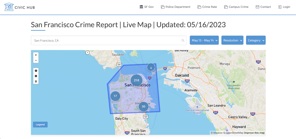
Crime rate statistics in open access

The Mapping Solution developed in collaboration with Mappitall is now available to the public and:
-
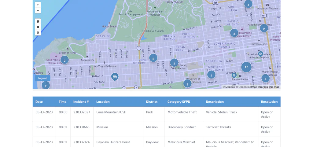
Visualizes the crime rate stats based on the dataset from the SPFD incident reports
-
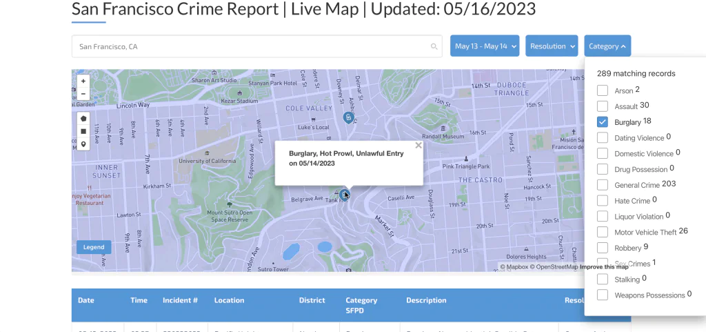
Allows to filter the data based on the time period, resolution (cite or arrest adult / juvenile, exceptional adult / juvenile, open or active), and category (arson, assault, burglary, general crime, etc.)
-
Provides a list of all crime incidents with their date and time, district, description, and other details
-
Displays crime incidents data across all San Francisco neighborhoods, universities, and colleges
-
Exports the data set in a spreadsheet for further use and analysis

Let's bring your project to life!
Use our expertise to design your custom mapping software solution.
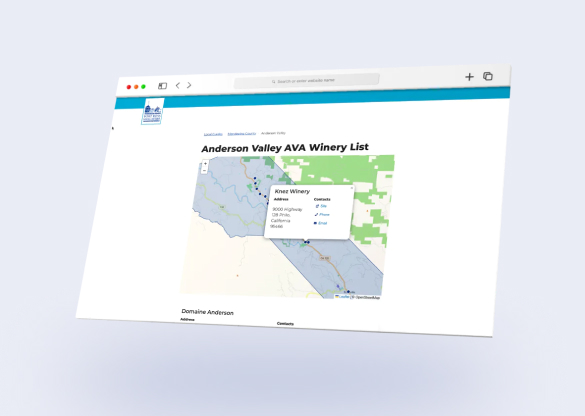
Mappitall cases
Related Case Studies
-

Rain Guardians
SFPUC Rain Guardians Program presents a map of rain gardens to a community of volunteers to help manage stormwater and keep them free of trash and debris.Look into the case -

Solano County
A US transportation authority builds intuitive maps for California residents and improves daily commuteLook into the case
around Solano county. -