

GIS Toolkit for
Road Lanes
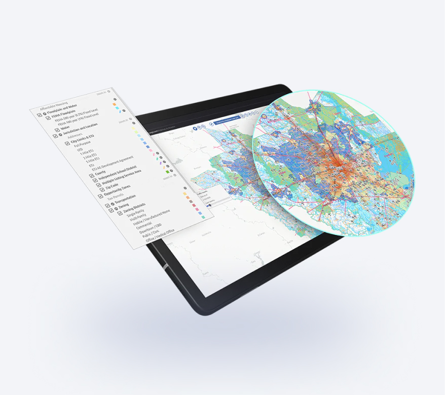
Project name Road Lanes
Movement of vehicles in real time.
-
Country:
USA, NV, Las Vegas
-
Industry:
Transportation
-
Project status:
October 2022
-
Front end:
-

ReactJS
-

MapboxGL
-

deck.gl
-
Site demonstration

Let's bring your project to life!
Use our expertise to design your custom mapping software solution.
Mappitall cases
Related Case Studies
-
FuseGIS
This software solution allows deep data and GIS data analysis of absolutely all parcels and properties within the territories Precise Austin, Dallas, Houston and San Antonio, TX GIS DataLook into the case -

Solaris
A sustainable energy company builds a GIS toolkitLook into the case
to inform the most efficient design and placement
of solar panels -

Utiligize
Green energy systems create a data-driven asset management program that reduces electrificationLook into the case
costs and informs investment decisions