LiDAR Mapping Services: The Ultimate Guide to Improve Indoor Mapping
LiDAR Mapping Services: The Ultimate Guide to Improve Indoor Mapping
January 8, 2024
Guides
Author: Volodymyr Ovramenko
Reading time: 9 minuntes
Currently, many organizations are using the latest light detection and sensing (LiDAR) technology to collect location data about customer assets. By leveraging this remote sensing technology, companies can easily present a range of geospatial outputs, such as digital elevation models, point clouds, and classified LiDAR. In addition, LiDAR allows for further analyses such as thermal line assessment, LiDAR indoor mapping, or vegetation management. In this article, we will discuss lidar mapping and how it works and answer questions such as what LiDAR data and systems are used for.
What Is LiDAR Mapping?
LiDAR mapping services stands for “Light Detection and Ranging” and is a modern technology that helps remote sensing, which helps in measuring Earth’s surfaces and mapping. LiDAR mapping is a process that involves creating detailed 3D models using laser pulses. Also, using this technology, organizations can create accurate models of terrain, features of the Earth’s surface, and other objects.
Key Benefits of LiDAR Mapping Services
LiDAR mapping services are essential aids in object modeling and sphere detection and have many benefits that make them valuable in a wide range of applications and industries. Below, we outline several critical benefits of LiDAR mapping services:
High accuracy. Modern technology allows you to accurately measure Earth’s objects, surfaces, and other features. It can also accurately capture parts to millimeters, which is ideal for applications requiring precise data collection.
Collect data in a short time. LiDAR technology can quickly and efficiently collect large volumes of data. This speed is often valuable for emergency response, infrastructure development, and urban planning applications.
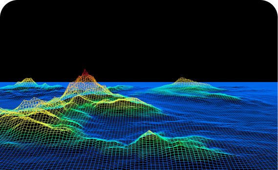
Possibility of 3D visualization. LiDAR can provide a detailed view of the surveyed area by generating 3D points. Thanks to 3D data, users can more carefully and deeply study the terrain and objects and conduct high-quality analysis.
Versatility for various industries. Modern LiDAR technology is often used in entirely different areas, which include cities, forests, regions, mountains, and even bodies of water. LiDAR is well suited for various applications, from forest management to archaeological site detection.
Work in any weather conditions. LiDAR systems are all-weather and can operate whether it is raining or foggy outside. This is a hallmark of the technology and makes it significantly superior to other remote sensing systems.
Remote sensing capability. LiDAR technology can successfully operate in hard-to-reach areas and remote locations, providing valuable data for environmental analysis, disaster management, or urban planning.
They are simplifying essential decisions. LiDAR mapping provides detailed information that helps organizations make decisions in various areas. This technology allows for more informed data collection, which helps reduce risks, appropriately allocate resources, and plan.
Overall, LiDAR mapping services are essential aids in many ways and offer a combination of accuracy, speed, and versatility, making them an invaluable tool for a wide range of applications. LiDAR can be helpful in various industries ranging from environmental conservation to urban development and disaster response.
DEM and DTM are digital representations of the Earth’s surface, especially its topography. However, it is essential to understand that they perform different actions and serve other purposes. To know how it works, you must familiarize yourself with each to study their characteristics.
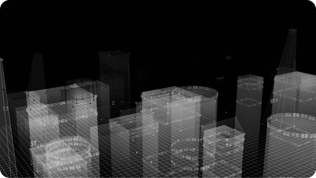
A digital elevation model is a digital representation of the Earth’s surface that allows users to record information about depth or elevation. Using this technology, you can represent natural landforms and other objects on the Earth’s surface. This may include various buildings, infrastructure, and even vegetation. I often use DEM in applications that deal with 3D visualization, urban planning, flood modeling, and more.
Also, with the help of it, users can conduct cartography and geospatial analysis. The DEM is as accurate and detailed as possible, but accuracy may vary depending on your data source and resolution. A digital terrain model is a subtype of DEM and allows you to represent the Earth’s natural surface or terrain.
DTM includes characters such as vegetation and buildings but focuses exclusively on the bare ground surface. This technology is precious in applications that require understanding the natural landscape, such as hydrology, site preparation for construction, and more. The accuracy of DTM also depends on the resolution and data source you are using, so the lower the solution, the more accurate the system can provide natural surface data.
The main difference between a DEM and a DEM is whether surface elements are turned on or off. It is important to remember that DEMs cover all ground objects, while DEMs focus solely on natural terrain. Before choosing between DEM or DTM, you must decide on the project requirements and study. It would be best if you had an accurate understanding of the natural surface or general data for areas such as environmental studies.
How It Works
LiDAR indoor mapping works in various ways, which you need to familiarize yourself with and determine which one is best for you. You can use this system to emit laser pulses from a sensor mounted on an aircraft or vehicle that are sent to the ground and hit objects of interest. In addition, LiDAR can measure flight time by calculating the distance between an object and the sensor.
Also, after data collection is completed, the point cloud that was created will be processed using a unique program that allows you to remove artifacts noise and classify objects. Thanks to these actions, LiDAR makes a holistic three-dimensional representation of the area, enabling you to collect the necessary data accurately.
How Do LiDAR Sensors Work?
LiDAR sensors work by emitting laser pulses and measuring the time it takes for those pulses to travel to a specific object and return to the sensor. This technology allows LiDAR sensors to create detailed and accurate 3D representations of the environment, resulting in precise analysis.
However, if you dig deeper, you can determine that laser pulses often take the form of short bursts of laser light that travel at the speed of light from the LiDAR sensor to the target surface or object. After the pulses hit the surface, they will travel back to the LiDAR sensor and record the time it took to travel that way.
Modern LiDAR technology can measure the time it takes for a laser pulse to reach a target and return, thereby creating a cloud of points, each associated with a specific point in the environment. The LiDAR system also qualitatively processes the collected data and filters out anomalies and extraneous noise. Such visualizations are necessary for those applications that deal with urban planning, vehicle navigation, and more.
Why Use LiDAR Mapping Services?
LiDAR mapping services offer a wide range of benefits that make them a valuable tool in various industries and applications. Below, we will talk about the main reasons for using this technology:
Ensuring high accuracy.
Fast data collection.
Versatility.
Detailed 3D visualization.
Penetration through vegetation.
All-weather operation.
Non-invasive.
Customization.
Economical.
Remote sensing.
Improved decision-making.
Safety and risk assessment.
As you may have noticed, LiDAR mapping services are valuable and versatile, combining accuracy and speed of data collection. This technology is ideal for use in many applications dealing with urban development, environmental protection, urban planning, etc. In addition, the ability to acquire highly detailed and accurate 3D data non-invasively makes LiDAR the preferred choice in many industries.
What Can You Use LiDAR Systems and Data For?
LiDAR systems and the data they generate have a wide range of applications across various industries. Below, you can see some of them:
Urban planning and development. LiDAR can assess road networks, urban infrastructure, or the height of buildings.
Forestry and vegetation management. With LiDAR technology, you can measure canopy structure tree height and manage forests.
Archeology. Modern LiDAR technology makes it possible to identify archaeological objects in vegetation or dense forests.
Geological surveys. LiDAR systems can map geological formations and help study landforms.
Flood modeling and risk assessment. Data collected using LiDAR is often used to create floodplain maps.
Environmental monitoring. LiDAR is often used to monitor changes in the environment.
Transport and infrastructure. This technology is critical for the design of transport infrastructure such as roads, railways, and airports.
Mining. LiDAR is used for quarry design, reserve monitoring, and mine safety assessment.
The versatility of LiDAR technology and its ability to provide highly accurate data have helped make it an essential tool in a wide range of fields. This system promotes more effective decision-making, improved planning, and risk reduction.
FAQ
What is the best indoor mapping software?
To select the “best” LiDAR mapping software, you must determine the specific needs and preferences that will cover your goals. Some of the most popular programs are Autodesk BIM 360, ArcGIS Indoor, and IndoorAtlas.
How can LiDAR measure a room?
LiDAR indoor mapping involves emitting laser pulses and measuring the time it takes for them to reflect from surfaces, creating a three-dimensional map of space.
How to use LiDAR technologies for flood risk mapping?
To use LiDAR mapping services for flood risk mapping, you must collect LiDAR elevation data, simulate flood scenarios, and assess vulnerability to better manage and prepare for flood risks.
How Scientists Use LiDAR Data?
Scientists often use LiDAR data to conduct precision geology, ecology, archeology, and more research. This technology helps to map terrain, detect objects, study ecosystems, and understand the features of the Earth.
Conclusion
In conclusion, modern LiDAR technology is essential to collecting necessary data in various fields. Using this system, many industries can significantly facilitate the visualization and modeling of objects. However, reliable LiDAR software must be used to meet your specific requirements and needs to achieve the best possible results. As you may have noticed, LiDAR systems have become excellent, widely used assistants, so using them in your work will surely achieve success.
How Can Mappitall Help With LiDAR Mapping Services?
Mappitall’s team of specialists is dedicated to providing quality services that enable customers to harness the capabilities of LiDAR systems and produce data collection that will help create robust visualizations and simulations. Mappitall conducts a thorough analysis of spatial data, which is based on modern technologies such as LiDAR. By turning to this platform, you can eliminate difficulties with data collection and other things, allowing you to get a positive experience of cooperation with the best specialists and qualitatively measure space without any problems.
Get in touch with us
Want to discuss your project?
Use our expertise to design your custom mapping software solution.
Just contact us:
Tell us about your project goals, and we’ll get back to you in no time!
An entrepreneur and business leader, Volodymyr began his career in the late 1990s at the Laboratory of Geoinformation Systems of the Kharkiv National University of Radioelectronics.
In 2007 Volodymyr created Mappitall, and grew the company from a small agency providing GIS solutions to one of the industry leaders in Ukraine, a reliable technology partner for many international enterprises and top-level organizations around the world.
As CEO, Volodymyr is the driving force behind the company’s strategy and business development, actively working on the development of Mappitall’s business model, attracting more and more talented people who share his vision and mission.