Thousands of businesses across the globe adopt BI-powered GIS applications for workflow optimization and cost reduction. In fact, the GIS market value is expected to grow from $63.61 billion in 2021 to $147.58 billion by 2028.
Applications that leverage GIS and BI (Business Intelligence) allow companies to track employees, assets, and equipment, as well as successfully collect and interpret the data in real time to make informed decisions. Therefore, custom GIS software not only addresses the current business needs but also reduces operational costs, allowing the executives to budget more effectively.
With years of experience working with GIS solutions for different industries, Mappitall helps hundreds of businesses to optimize their performance at a fraction of the cost. In this article, we’ll analyze the specifics of using GIS and BI: how they help with cost reduction and how to create a custom GIS solution that will help your business to develop and scale.
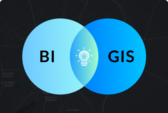
Benefits of Using GIS and Business Intelligence
By storing and managing geographic information, GIS technology helps enterprises to make cost-efficient business decisions based on the specifics of their field and assets.
Besides simplified examples of Google Earth and Apple Maps, businesses can now improve their performance with effective data visualization, advanced analytics, and powerful forecasting solutions aimed to enhance overall organizational efficiency while minimizing costs.
Some examples of how GIS help reduce operating costs in BI are:
Tracking key business processes
Applying operational knowledge instantly
Creating reports and models that display up-to-date business data
Increasing analytical and decision-making capacity
Managing an organization’s performance effectively
Nearly 60% to 85% of business data includes spatial components, so the importance and usability of such applications cannot be overestimated today. Factual spatial information in GIS and BI is particularly useful for logistics, facilities management, strategy, marketing, and many other business aspects.
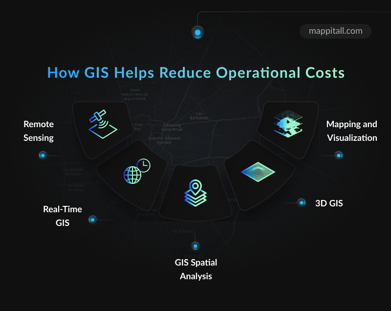
GIS software is based on spatial modeling, which opens up plenty of opportunities for business optimization and development. Here are key features of GIS software that prove particularly useful in optimizing business operational costs.
Remote Sensing
Powered with active microwave sensors from radar, lidar, sound, and many other hardware solutions, GIS software can effectively map locations and collect data from the objects on the surface. The key functions of remote sensing are:
Detecting and monitoring the physical characteristics of an area
Analyzing the progress of land use in the historical aspect
Detecting impervious surfaces
For example, remote sensing GIS solutions can track environmental changes and address related issues. Urban planners use them to explore the areas of environmental sustainability and identify the most cost-efficient ways for location development. As such, remote sensing in GIS is extremely valuable for the construction, environmental protection, agriculture, urban planning, transportation, and many other industries.
Another great advantage of remote sensing is the ability to leverage spatial data for risk management regardless of the user’s location. Companies can track sensitive data changes and make immediate business-related decisions using real-time information.
Real-Time GIS
The immediate geographic insights are another essential characteristic of GIS in business intelligence that helps to enhance decision making and mitigate risks. Enterprises can quickly react to business data changes and operate the information in real time, addressing the issues that matter the most.
This option is exceptionally important for public services (public works, public health, public safety), defense and intelligence operations, emergency management, and so on. Besides, real-time GIS is applied in critical infrastructure that requires constant tracking and immediate response, including transportation and utilities, water and gas management, forestry, mining, and more.
GIS Spatial Analysis
Similarly, businesses can use GIS to reduce costs in terms of spatial analysis, where large amounts of data are processed automatically and more efficiently. GIS BI solutions can help you to:
Determine the relationships between multiple data categories
Detect and count patterns
Forecast changes and conduct historical analysis
Spatial analysis in GIS speeds up the analysis of business-related data, starting from customer behavior and marketing strategy to competition tracking and operational optimizations.
3D GIS
Businesses are extensively using GIS to reduce operation costs with the 3D solutions. In particular, the following data segments can be modeled:
Urban areas and their details (population density, infrastructure, transportation system, etc)
Lands used for construction
Aircraft positions
The 3D mapping GIS solutions are mainly applied to create accurate, geometrically correct, and topologically consistent 3D models automatically in real-time. Some of its use cases can be found in city planning, coastal modeling, traffic simulation, and other fields.
Mapping and Visualization
Finally, some companies leverage the advantages of GIS to reduce costs by creating functional and informative maps that display a specific dataset and relevant information.
Mapping and visualization facilitate the interpretation of geo-based data (images, charts, maps, diagrams, 3D views, etc) and associated table datasets. From the business point of view, this feature generates more profits and leads to more efficient decisions.
GIS Application Areas Where Cost Reduction Is Effective
Similar to the functionality of the GIS-powered platforms, it’s also essential to identify the areas which can benefit from using GIS to reduce operation costs. Overall, these can be divided into the following segments:
Customer Relationship Management – businesses can obtain more accurate audience data, track their preferences, and carry out behavioral analysis to improve the quality of the products or services delivered.
System Management – companies can significantly optimize their workflow and automate operational processes with less input of time and effort.
Marketing Strategy – GIS BI solutions provide different types of regional data required to enhance the advertising and promotional efforts, such as targeted marketing, product launch events, location-based promotions, and so on.
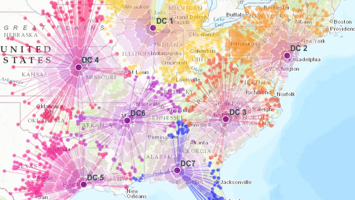
Inventory Management – combined with Business Intelligence, GIS software can address any issues related to logistics and transportation, covering the delivery routes, distance, timing, etc.
These are only a few examples of GIS application use cases that can benefit cost reduction and operations improvement.
Having realized the full potential of geographical information systems and business intelligence solutions, it’s the right time to invest in custom GIS software that fits your business objectives and needs!
Create Custom GIS Solutions for Your Business with Mappitall
The Mappitall experts have been providing advanced mapping solutions for over 15 years to help companies develop and scale across industries.
With nearly 100 projects delivered, our team has accumulated a wealth of expertise in GIS apps to streamline business performance and generate impressive revenues from day one. Here are a few happy clients from our portfolio who slashed costs with Mappitall GIS development agency:
SolarPlus has obtained maximum power generation with minimum equipment costs while installing solar panels.
Ugitilize received a GIS-powered asset management system that visualizes data from various sources, like cables, transformers, and street lights, and optimized electricity network accounting.
FuseGIS had a mapping solution designed to save time, cost, and resources for brokers and real estate agents.
…and many more!
Our best developers keep their fingers on the pulse of the latest trends in GIS tools for business, ensuring every client gets a competitive, future-proof solution to achieve their objectives.
Have a project that needs help? Get a quote from Mappitall’s best GIS experts and find out the best way to enhance your business today!
Final Thoughts
Now that you’ve discovered the key benefits of GIS BI software, you can think of a plan to reduce operational costs with GIS for your business.
Making an investment in custom GIS development is one of the proven ways to increase business profits, optimize expenses, and significantly improve the efficiency and effectiveness of a company’s business model.
Contact us right away to discover the best practices in enhancing business performance and reducing costs with GIS solutions today!
Frequently Asked Questions
How does GIS reduce operational costs?
Integrated into a business operations model, GIS tools can become a cost-effective solution to improve decision-making and risk management processes. With real-time data analysis and advanced analytics, the technology allows businesses to quickly react to changing conditions and share real-time data from multiple sources and devices.
What is GIS in business analytics?
As a component of business intelligence solutions, GIS software stores and manages the critical geographic information that is processed and analyzed to make better, data-driven business decisions. Therefore, GIS allows efficient data interpretation onto a map using spatial analysis and geocoding.
How can GIS be used to improve the business?
There are a variety of benefits GIS technology can bring to different companies. It speeds up communication between different departments and employees, enhances geographic data storage and operations, as well as improves decision-making.
All these advancements have a huge impact on business performance and profitability.
How does GIS increase cost efficiency?
Basically, GIS software can minimize business expenses while increasing its performance and internal workflow. For instance, this technology allows us to speed up data processing and come up with more cost-saving solutions.
Similarly, it allows effective access to the risks and enables better forecasting prospects across multiple business aspects, which immediately impacts the financial outputs of your business operations.
Get in touch with us
Want to discuss your project?
Use our expertise to design your custom mapping software solution.
Just contact us:
Tell us about your project goals, and we’ll get back to you in no time!
An entrepreneur and business leader, Volodymyr began his career in the late 1990s at the Laboratory of Geoinformation Systems of the Kharkiv National University of Radioelectronics.
In 2007 Volodymyr created Mappitall, and grew the company from a small agency providing GIS solutions to one of the industry leaders in Ukraine, a reliable technology partner for many international enterprises and top-level organizations around the world.
As CEO, Volodymyr is the driving force behind the company’s strategy and business development, actively working on the development of Mappitall’s business model, attracting more and more talented people who share his vision and mission.