Since its first introduction in the late 1970s, GIS software has already become an integral part of many industries. Tourism is no exception: today, you can find plenty of use cases for GIS solutions aimed to enhance a traveler’s experience by making their trips more comfortable and memorable.
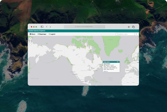
GIS tourism software opens up a wide range of opportunities for the hospitality industry. In particular, such solutions are already used in different standard options like trip planning, online bookings, and location-based services, as well as some advanced – such as decision support systems, cultural heritage tourism, geospatial collaborative tourism recommender software, and many more.
In this article, you will explore various applications of GIS in tourism and hospitality, their key benefits, and the major solutions this software can provide to your business once implemented.
GIS and Tourism Market Size
For hundreds of countries across the globe, the success of the tourism industry will mainly depend on their ability to develop, manage, and market journey-related facilities, destinations, and activities. In fact, many countries rely on the traveling industry as the main source of economic support.
Fortunately, the application GIS in tourism opens up a large number of opportunities for both businesses and their clients. These systems allow leveraging up-to-date information and performing various analyses to optimize performance, reduce costs, improve services, and many more. Let’s explore deeper some of the most essential advantages of combining GIS and tourism.
Overall, the most notable impact of GIS on tourism can be described as follows:
Improved communication – a smart GIS platform can significantly facilitate the cooperation between different departments and allows them to constantly access up-to-date geographical information, perform specific analyses, reports, etc.
Increased income – increased productivity, automated workflow and optimized data management enable companies to cut operational costs and optimize their expenses.
Social benefits – application of GIS in hospitality improves the quality of the services within the tourism industry, which in return generates higher revenues and improves operations.
Enhanced security – most GIS platforms feature advanced security policies to store sensitive data in case of a cyber security attack.
More accurate data transmission – tourism and hospitality companies can record and manage their most recent geo-based data and effectively share the information with other departments using a single system. This is exceptionally important to improve the business performance, optimize the costs, and create an excellent service for each traveler.
Apparently, GIS technology brings a wide range of opportunities to hospitality management. Sooner or later, it will no longer be an option but a necessity.
What GIS Solutions Can Be Created for Tourism
The use of GIS in tourism goes far beyond the theoretical advantages and research insights. The most typical instances of managing tourism using GIS are:
Digital mapping solutions
Series of maps, related to a particular topic or industry segment
GIS-powered atlas – collections of geographic information (maps, apps, and various data layers)
Virtual tours for hospitality institutions, restaurants, tourist destinations, and more
Below we will consider in more detail the use of GIS for tourism and hospitality.
Application of GIS in Tourism and Hospitality Industries
Extensive use of geographic information systems in hospitality and tourism has naturally stimulated the evolution of numerous use cases of GIS solutions for business profit.
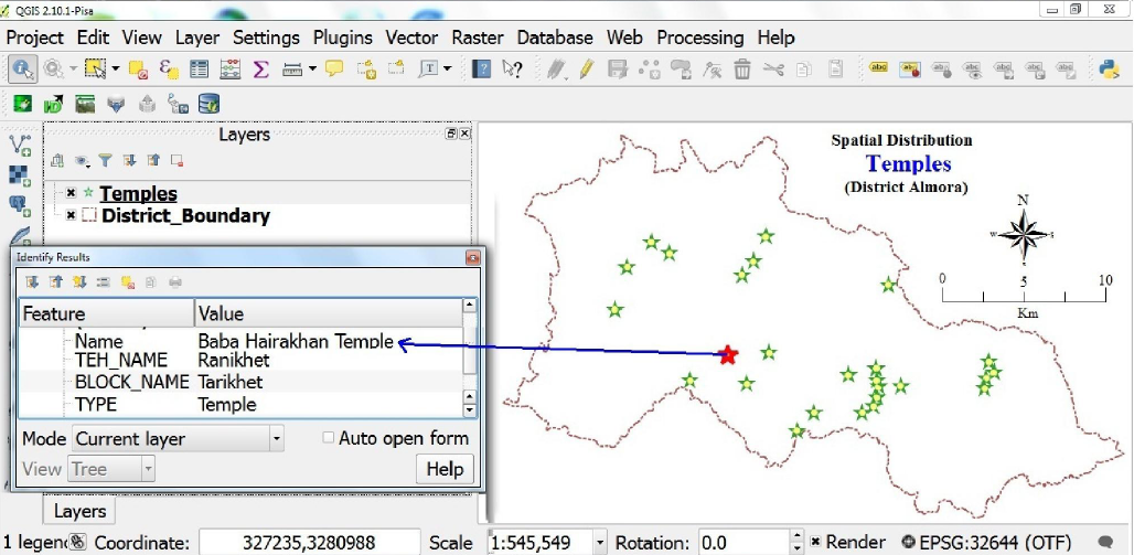
GIS and Network Analysis
The power of spatial analysis in GIS allows businesses to identify the recent trends in location-based search and generate new data-related connections. Business owners can review complex relationships between the data categories and come up with the most efficient decisions in the terms of tourism development.
Such a model has been applied in the Greater Imphal area, where the GIS-powered software was applied to help local authorities in building the most efficient travel direction, as well as identify the closest facility.
GIS-based applications can build functional tourist maps based on different types of data. They usually focus on the location’s history, its surroundings, the routes to reach it, etc.
An excellent example of scenario planning was tested in 2010 at Sagarmatha National Park. The researchers set up a list of workshops to explore the future development of a park, define the factors that impact the park and tourism development, and find out the alternative future scenarios for SNP and tourism.
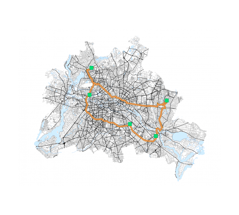
Subway Maps
GIS solutions for tourism can simplify the subway mapping data so that it is easier to interpret for the non-locals. Large cities with a tangled subway system, like New York, Shanghai, and London, can particularly benefit from them.
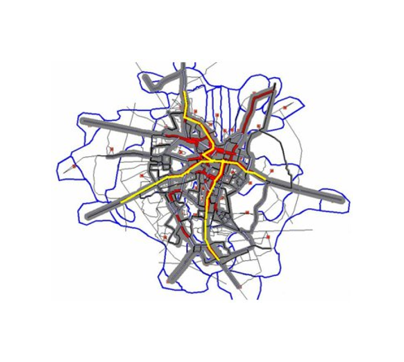
Spatial and non-spatial data of GIS systems allow accessing real-time information about the traffic situation, available transport options, and most optimal routes to a particular place.
One of the most popular models used for tourism flow modeling in the UK is the Kernel Density function. It uses vector lines data and density mathematical function to spatially represent the objects’ characteristics. This analysis has become widely implemented in hundreds of tourism-powered cities in many European countries, the US, the UK, Australia, China, and Canada.
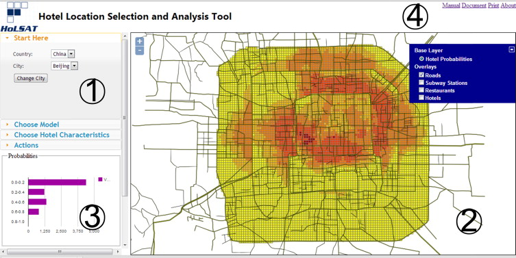
Hotel Search
With the large amounts of spatial data collected and processed, GIS applications allow tourists to discover and compare different accommodation options available within a specific location. In turn, business owners can identify the hottest locations booked as well as spot some low-income infrastructure that requires optimization.
Such a solution was implemented at Marriott Hotels, where the GIS-powered decision support system is put in place. It estimates the objective hotel room rates and location characteristics, as well as predicts room rate prices by season.
GIS solutions also help to create trip scenarios for different audience segments, covering not only tourists but also visitors on business trips or on family vacations.
For instance, Handheld GPS allows tracing of people’s daily travels in major cities worldwide and detects the most optimal travel mode for a user. This software has been successfully tested in some large cities across the US (New York City, Washington DC, etc).
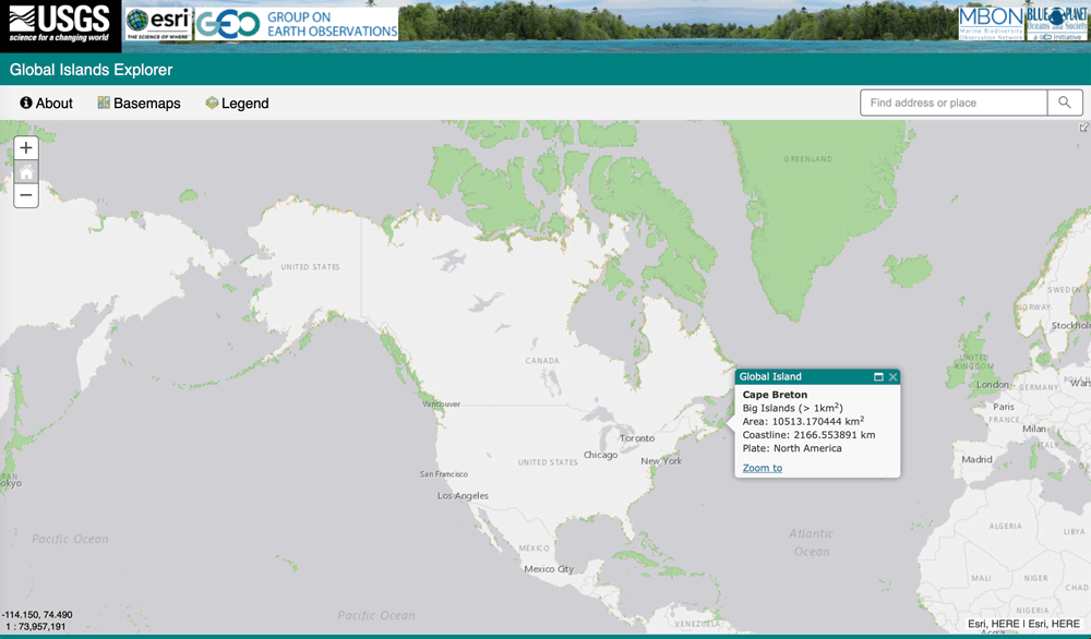
Finding Islands
With GIS solutions, it’s possible to discover new islands all around the world with the help of satellites. That’s how Landsat Island was discovered only 50 years ago and became an important landmark of the Canadian landmass.
With the ability to capture, store, check, manage, and analyze various types of data, GIS systems provide a large number of opportunities for enhancing marketing efforts and spotting new areas where particular local destinations or specific services can be promoted.
An experimental GIS application has been launched for Alberta Ski Resorts, where this technology was used to provide real-time map displays and effectively organize spatial information. Tourists, in turn, were able to calculate the traveling distance, distances between attractions, and trip feasibility.
Mappitall Can Help With GIS Solutions for Your Tourism Business
Ever since Mappitall was established in 2016, we have been excelling in advanced mapping solution development for hundreds of companies across all business verticals. Tourism is no exception.
In our extensive portfolio, we have introduced some of our most recent GIS solutions that have been successfully integrated into the business model and already started generating impressive revenues.
One of the recent projects we worked on is the development of the Vaccines.gov app that helps users locate the closest Covid-19 vaccination center in their area. By aggregating all national vaccine providers and up-to-date information on vaccine availability, the software significantly simplifies access to the treatment especially for people traveling the country.
Final Thoughts
Multiple applications of GIS in tourism have illustrated that GIS solutions are a powerful and efficient tool that can greatly help in trip planning and decision-making. It’s now widely applied for auditing environmental conditions, planning and modeling processes, inspecting location parameters, and adjusting to the traveler’s needs.
With the spatial and non-spatial data getting more consistent, tourism and hospitality businesses start heavily investing in various GIS solutions to enhance their operational performance and cost-efficiency.
If you’re considering the custom GIS project for your business, contact the Mappitall professionals today. Our team is always ready to provide the most efficient software solution for GIS in tourism that can fully cover the company’s goals and increase its profitability.
As a rule GIS tools are integral components of modern tourist applications, aimed to provide new avenues and enhance the tourist experience in different ways. For instance, it helps to finalize the tourist destination based on the comprehensive data of a particular place, its culture, and local attractions to help in making the best impression on the visitors.
How to determine the tourism revenue using GIS?
In recent studies, GIS technologies became extremely valuable in the tourism industry, as they help to analyze the spatial relationship between different elements of urban tourism. This covers the performance and revenues of the hospitality industry, tourist attractions, tourist routes, and other social, environmental, and related factors.
What are the main components of GIS in tourism?
Tourism has four main components, commonly referred to as “4As”: Attractions, Access, Amenities, and Accommodation. GIS in tourism will serve these goals bringing hardware, software, people, and network communication to meet the travelers’ expectations.
How popular is the use of GIS in hospitality management?
GIS for tourism is new and extremely prospective technology that has been now gradually implemented into modern travel and hospitality units. This software is used for bringing the georeferenced data (spatial and non-spatial) of a particular geographic location into digital maps to enhance the performance of hospitality businesses and increase their revenues.
In particular, GIS in hospitality management contributes to trip planning, online bookings, multiple location-based services, and topics within the target field.
What are the functions of GIS in tourism and hospitality?
GIS solutions can be used as powerful supporting tools for sustainable tourism planning, impact assessment, visitor flow management, and tourism site selection. Some of the major functions of GIS application in tourism include digital basic maps, digital files for analyzing and mapping, digital files for mobile mapping and modeling, and digital multimedia.
Get in touch with us
Want to discuss your project?
Use our expertise to design your custom mapping software solution.
Just contact us:
Tell us about your project goals, and we’ll get back to you in no time!
An entrepreneur and business leader, Volodymyr began his career in the late 1990s at the Laboratory of Geoinformation Systems of the Kharkiv National University of Radioelectronics.
In 2007 Volodymyr created Mappitall, and grew the company from a small agency providing GIS solutions to one of the industry leaders in Ukraine, a reliable technology partner for many international enterprises and top-level organizations around the world.
As CEO, Volodymyr is the driving force behind the company’s strategy and business development, actively working on the development of Mappitall’s business model, attracting more and more talented people who share his vision and mission.